Grassroots Mapping is a series of participatory mapping projects involving communities in cartographic dispute. Seeking to invert the traditional power structure of cartography, the grassroots mappers used helium balloons and kites to loft their own “community satellites” made with inexpensive digital cameras.
At Public Lab, we've grown the Grassroots Mapping community into a broader effort to enable communities to understand and respond to environmental threats with DIY techniques.
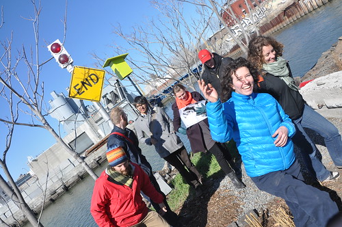
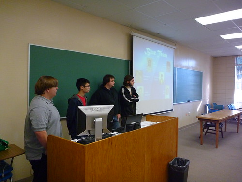
During the weekend of March 25-27, 2011, PLOTS staff – Jeff Warren (Boston), Liz Barry (New York), Shannon Dosemagen (New Orleans), Adam Griffith (Asheville), Mathew Lippincott (Portland), Stewart Long (Oakland) and Sara Wylie (Washington D.C.) – met in New York for the first PLOTS summit. We were able to come together for our first staff meeting due in part to the sponsorship of MITs Center for Future Civic Media.
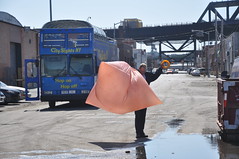
On Friday, PLOTS was invited to teach one of the Trade School classes at the Whitney Museum of American Art – we were easily identifiable with a Mylar balloon floating in the outside courtyard. Despite the cold temperatures, students came to our Make Your Own Spectrometer class where they created spectrometers with paper tubes, CDs, razor blades and tape. Interested in trying out your own or have ideas on how to improve the design? Check out the spectrometer page on the Public Laboratory website. After making spectrometers, students were able to look at water samples collected from the Gowanus Canal and various puddles of standing water from Central Park. Having just released the online spectral analysis tool, students were then given a demonstration on analyzing samples and the first steps in identifying polycyclic aromatic hydrocarbons (PAHs), as this tool is still in development.
Saturday brought a full day of meetings where, amongst other things, we discussed potential upcoming projects including mapping in Salt Lake, Utah and Lome, Togo and decided on creating a website similar to data.gov for all of the images that have been collected on the Gulf Coast and at other sites. We additionally discussed tool curriculum, research goals, incorporating PLOTS into a nonprofit and some of our retail endeavors in the upcoming months – maps, t-shirts and starter kits for mapping. We also decided on a couple of larger PLOTS community events for the next year. The first is what we are calling a “barn raising” where we pick a site that PLOTS team members have been working at and host a 3-4 day workshop where tools are tested in cooperation with community members and others that can help test and solve problems with each tool in use. Potential sites for the 2011 barn raising include Butte, Montana, Grand Isle, Louisiana, and Wiley’s Last Resort in Kentucky. Also in the works is a PLOTS conference with workshops, roundtables and other small sessions for tool and idea R&D. We are looking at early 2012 to host this first gathering.
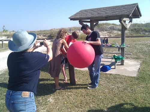
On Sunday, we headed to the Gowanus Canal Superfund site, where we have an active aerial mapping project happening in partnership with the Gowanus Canal Conservancy. One of the difficulties that we’ve experienced with the site is that strong and unpredictable springtime winds have given mappers difficulties as balloons are popped on the barbed wire that lines the heavily industrialized canal. Charles A. Stewart from Let’s Fly Kites came to meet Liz Barry and Leif Percifield who lead the project at Gowanus and as an expert kite flyer, brought a couple of his kites to demonstrate. The new kites that we tested had structure and flew well with the rig attached. Liz and Leif decided on a Delta-Box hybrid model to try out during future mappings of the canal.
What should you look for coming out of this weekend? Lots! And we hope that you all will be active contributors going forward! Next online in the coming month – the first printed maps of the Gulf Coast thanks in part to a sponsorship from Development Seed.
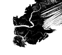
>>Question : How can you extract the % of wetland from an UV aerial picture using photoshop?
Video tutorial by Cesar Harada and Adam Griffith:
_ Instructions :
1. isolate the part that you are interested in using the menu/ image/ adjustment/ replace color. There you want to have a quite fuzzy selection and darken the desired part.
2. after isolating the part you are interested in -black area- apply menu/ image/ adjustment/ threshold
3. use magic wand /untick “contiguous” pixel to select all the black pixels available. Open menu/ window/ histogram/ expanded view. Here you will see how many black pixels are selected. Now you know how many black pixels there is on this image – corresponding the area of wetland from the original UV picture. You can convert the number of pixels into a % (proportions of wetland) or in surface area for quantifying. It is possible to optimize this workflow by creating a script or recording the chain of actions.
Same thread on Public Laboratory
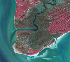
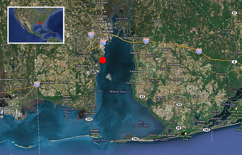
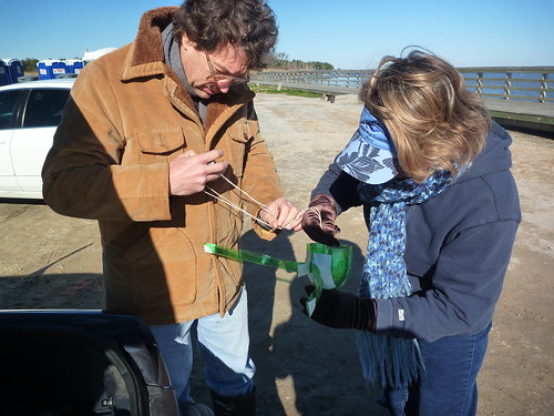
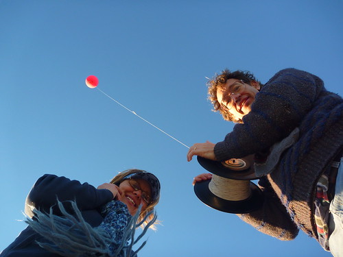
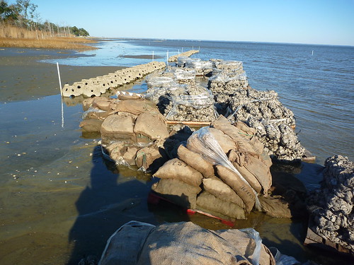
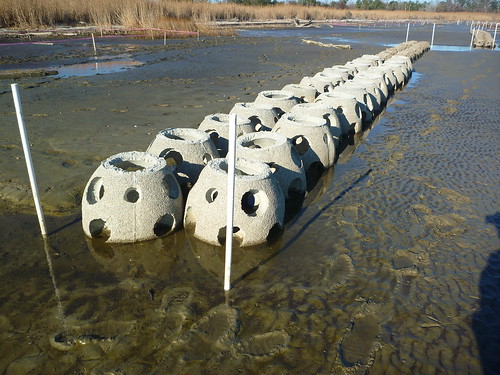
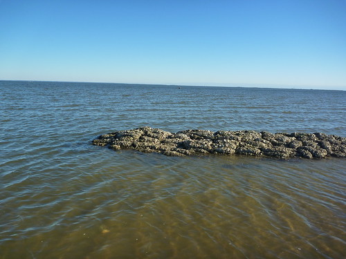
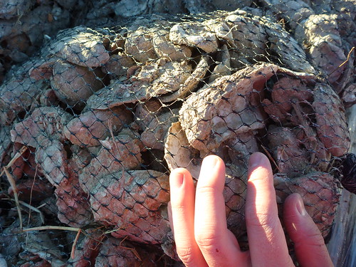
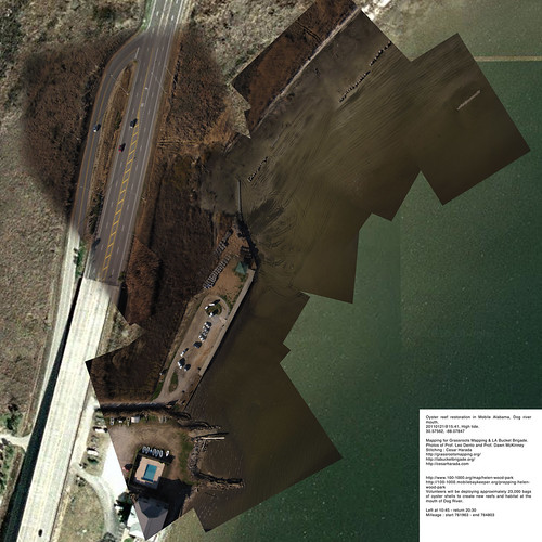
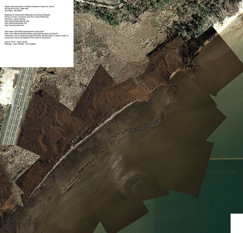
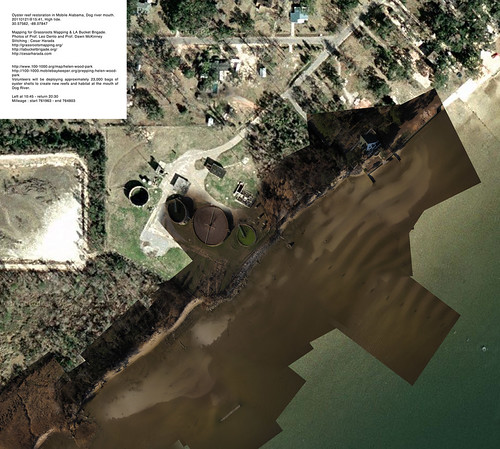
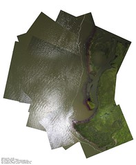
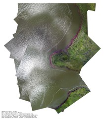
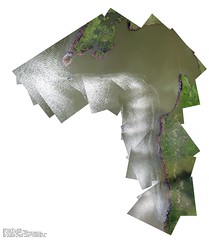
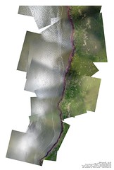
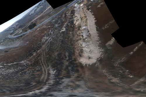
Yesterday we went aerial mapping a landscape that is just about to change radically : restoration of the oyster reef in Mobile Alabama, Dog river mouth – known as Helen Wood Park beach. In two hours from now (2011 January 22 6AM), hundreds of volunteers will come to install a massive oyster reef here. From 8AM today “Volunteers will be deploying approximately 23,000 bags of oyster shells to create new reefs and habitat at the mouth of Dog River” – see them in action here .
These are the different reefs and bags of oyster they are installing. 5 non-profit organizations are working together to accomplish this massive landscaping project.
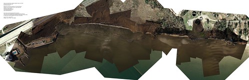
We took about 5000 aerial pictures that I turned into 3 very large resolution maps to make one huge map (at the top of the post):
Download these full resolution maps to your computer as .zip file (27mb). If you want to learn how to make one of these map, check this post.
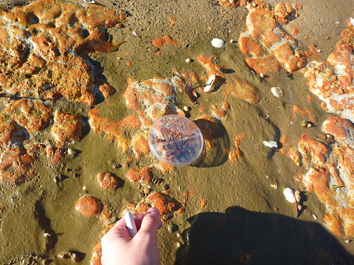
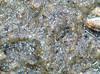
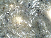
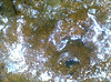
This time, in addition of aerial photography, I also took ground samples (~250x microscopy), sand, sediment, organic material taken at regular interval. The idea is : if we are able to say what is on the ground – sometimes we may find oil spilled still – we can qualify and quantify what we see on the aerial pictures. We will come back in a few weeks to map again and see the effects of installing an artificial oyster reef here : “before and after” 🙂
This post was written by Christopher Johnson, a student at South Alabama University that participated in the Grassroots Mapping project in Alabama.
Hello! My name is Christopher Johnson, and I was one of the University of South Alabama (USA) students to participate in the Grassroots Mapping project in Professor Dawn McKinney‘s Computer Science class. It was a bit weird to go outside and do a project, since our majors are all computer-related, but I think in the long run the class was better for it.
Basically we were broken into teams of around six, each team having at least two of each major: CS, IT, and IS (not our actual majors; we were assigned a major for each third of the course, which we rotated). We had to work in teams to stitch together parts of Dauphin Island using Cartagen, among a few other things essential to the Freshman course.
Most of the technical problems came with Cartagen being down for a short period and unusable pictures – the nice sea breeze can be a difficult adversary. Another difficulty was overcoming the challenges we created ourselves, such as arguments within the group and people not showing up for class.
Overall it was a very good learning experience; I was one of those who went to Dauphin Island (taking the pictures was optional), and we had a lot of fun. I’d definitely do it again, given the opportunity, and I recommend that everybody go out there and try to make a difference. It’s more fun than you think, and you can really make a difference in your community!
A group of students attending Western Carolina University, under the guidance of Adam Griffith, took on the project of mapping the campus using aerial photography in the fall of 2010. The project was initiated because there was concern about the Google Earth images that covered the campus and the surrounding Cullowhee area. Satellites for Google Earth images only pass by every couple weeks and our campus is experiencing lots of change through construction of new buildings and new facilities that Google Earth does not reflect. Also, the images are of extremely poor quality, and unless you are familiar with the campus it is difficult to discern cars and some buildings and small structures.. This is where we come in: our images taken only 1000 feet in the air are of much better quality and clarity than those in Google Earth, and when we complete the project we would love for Google to insert our images into their maps.
Process
The photographs were taken by suspending a camera inside the top of a 2 liter soda bottle and attaching this setup to a 250 gram balloon which was on 1000 feet of string (see materials picture d). We also used the same soda bottle-camera rigging attached to a kite to test which produced better photos (balloon). The balloon was pulled by hand by students on the ground and was navigated around campus, making sure to steer clear of tall buildings, trees, and other high objects that could snag the string. The camera was 14 megapixels and was set on continuous mode so it would take about a picture per second while up in the air. After several flights, we discovered what conditions were most suitable to our endeavor. The best photos were taken when the sun was out with no clouds in the sky. Lights winds were fine, but heavier winds caused the balloon to be jerked around, which would not allow the camera to focus. Advice for other mappers would be that no matter what equipment you use to take your aerial photos, make sure it is sturdy enough to withstand a fall! We experienced a malfunction where the balloon burst while we were pulling it in, and the camera struck pavement roughly. Luckily it survived with little to no damage.
Stitching
When first reviewing the outline of the project, stitching the photos together to form the map seemed like a simple enough task. We found out otherwise. The photos chosen had to be almost completely straight down and in focus on the area being photographed in order for them to be properly stitched together to fit Google Earth. Because the camera was in so much motion while in the air, there were very few pictures that turned out to be completely straight down. Due to this fact, we had to warp several photos when they were stitched and manually force them to mirror Google Earth. Stitching these photos turned out to be the most difficult and time consuming task for the whole project. However, our end product was such an improvement over Google Earth that the effort was worth it. Our photos had about 7cm resolution or 7 cm per pixel, which is a vast difference from Google Earth.
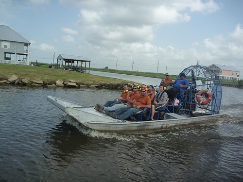
Hi, Cesar Harada here, first post and first map using the techniques of Grassrootsmapping.org for LA Bucket Brigade – thanks guys for putting this wonderful DIY technology together. So! In the late morning 22nd of July 2010, Hunter Daniel and myself went to map out of Port Sulphur, on these funky boats :
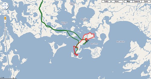
I traced this route with my mobile phone Google Nexus One and the fantabulous Open GPS tracker for Android – 4 stars rating!
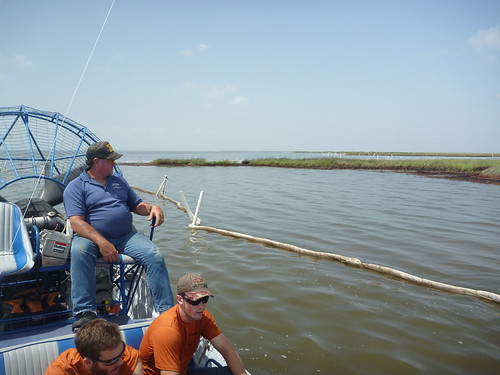
This is what we could see from the boat, kinda boring :
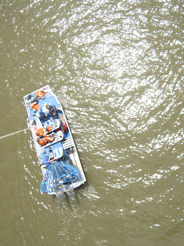
Soon after I launched a balloon and Hunter a kite out there, kinda exciting :
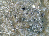
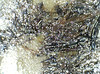
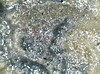
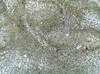
we captured nice pictures, here 6 details :
These 6 pictures were made using 270 stills… that was a 12 hours work on photoshop since hugin (an open-source photo mosaic software) didnt do the trick – yet :/ Still working on it to automate the process and spend more time sipping mango juice 🙂 Read the rest of this entry »
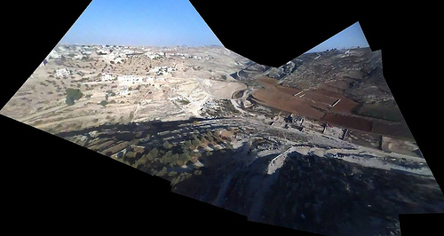
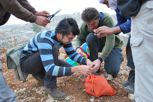
The day after working with landowners and activists in Umm Salamuna in the West Bank, we stopped by to visit Alice Gray, who organized the protest. She runs a permaculture farm project in Bethlehem called Bustan Qaraaqa, and was interested in mapping the farm periodically to monitor growth and erosion. She was quite excited about the kite concept so we thought we’d give it a try.
The attempt was somewhat frustrating – while the day before we had over 30mph winds, at the farm we had the opposite problem: very little wind. BQ is located in a sharp valley where it’s hard to get a view from above (see picture) but we finally managed to loft a small parafoil kite (thanks Nadya!) with an iPod nano attached. We let it out about 500 feet, but the kite flew at a very low angle, and in the wrong direction. In the end we got a reasonable image of the other side of the valley, which we’ll try to rectify as a proof of concept.
We’re using VLC to review frames manually, saving the clearest ones as PNG images. Then we use hugin with the SIFT algorithm to auto-stitch the video frames together. This is a bit involved and if we continue using video we may want to make a web interface to do this automatically. As in: point it at a YouTube video and it generates a panorama as well as it can and opens it in Map Warper. As it turned out, the hilly terrain proved too much to successfully warp this capture into a usable map; see the final product. What we need is a much higher point of view, if there are going to be any hills. Luckily some of the kites I bought in San Juan last week are ideal for this – and they fly much more vertically so we won’t have to worry about being as far upwind of the target site.
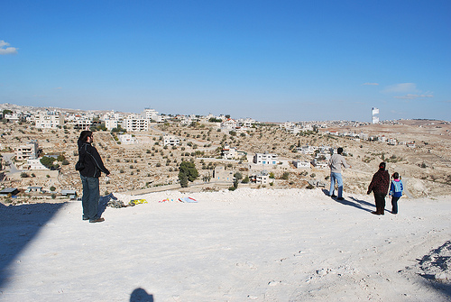
These two days definitely show the ‘worst case scenario’ for this kind of mapping… super high and low winds, steep valleys and ridges, low-res video and time limitations. Anyways the best part of the day was when two Palestinian kids and their dad came out to see who the idiots were who couldn’t fly a kite… and helped us get one in the air:
Coming soon – our last day of mapping in the middle east was at the Royal Scientific Society of Jordan, where we captured some absolutely fantastic images under some of the best conditions we’ve seen so far.
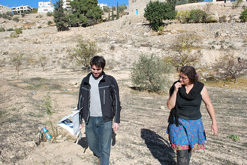
Josh Levinger and I met up with some activists who were planting trees in Umm Salamuna (view in Google Maps) on a hillside which is scheduled to be annexed by a nearby Israeli settlement, and converted into a graveyard. The planting was organized by Alice Gray of Bustan Qaraaqa, so that if the land is taken over, the trees would have to be uprooted or chopped down before the land can be used.. As I understand it, one of the means by which settlements claim land is by using an Israeli law which opens land to new settlement if it has lain fallow for more than three years — so planting the hillside may defend it from such a claim.
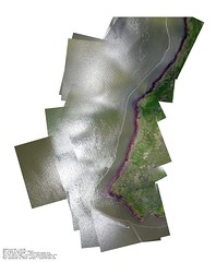
The wind was so strong that our first kite, carefully made that morning from dowels and Tyvek, shattered immediately. Instead, we launched a small soft kite with an iPod nano attached to it. Here’s a stitched image of the video footage we captured:
The iPod has an SD camera which can capture many hours of video – and it’s so super light that we can fly it on a pocket kite. Many of the frames are blurred and the resolution is pretty poor (we’d thought of using a Flip camera but they’re more expensive and heavier) but when you go through the footage frame by frame you can find lots of good images. We then stitched these together with Calico and got the above image. It helped a lot to put a small ‘sail’ on the back of the iPod so it didn’t spin as much.
Everyone was cold but once we started flying the kites we all got really excited. The owner of the land was there with his kids and they helped assemble the rig and fly the kite:
The mapping was a big success – everyone ‘got’ why we were doing it, that documenting the tree planting and how they’re changing the landscape is a form of testimony. We’re still working to rectify the imagery, and I’d like to ask folks if they have any ideas – the stitching software we’re using assumes images were taken from a single viewpoint, but the kite and camera were moving all over the place. As you can see above, the stitching distorts things and we lose a lot of detail – how can we reconstruct a high-res image that assumes multiple perspectives? I’m looking at this tutorial to start with. We’re also thinking about an algorithm to dump the clear, undistorted and unblurred frames from a movie file. Ideas?
Hello all! I just put up a wiki at wiki. as a place to organize and share tips and techniques for making low-cost, participatory maps, whether by GPS, balloon photography, or sextant. Feel free to edit, improve, adapt!
Are you embroiled in an cartographic dispute? Do you disagree with the official version of your geography? Contact us through the public mailing list.
Grassroots Mapping is part of the Public Laboratory for Open Technology and Science, founded by a group of activists, educators, technologists, and community organizers interested in new ways to promote action, intervention, and awareness through a participatory research model.
Purchase the Grassroots Mapping Forum, our new community research journal/archive/zine/map, where we hope to share ideas, techniques, and stories from the Grassroots Mapping community. It is printed on a single 22.75x35" newsprint sheet, folded down to just over letter size, and includes a full color reproduction of a grassroots map along with essays, illustrated guides, and interviews on the reverse.
We're helping citizens to use balloons, kites, and other simple and inexpensive tools to produce their own aerial imagery of the spill… documentation that will be essential for environmental and legal use in coming yeas.We believe in complete open access to spill imagery and are releasing all imagery into the public domain.
Techniques and tools for people who want to make maps, on the Public Laboratory wiki. Includes readings and case studies on grassroots mapping projects.
You are currently browsing the archives for the Blog category.