March 15th, 2011 by Adam Griffith
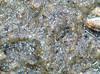
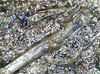
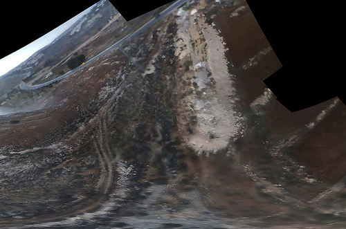
During the first week of March, students enrolled in Dr. Rob Young’s field trip course at Western Carolina University attempted to map coastal wetlands using Grassrootsmapping techniques in Beaufort County, SC. Beaufort County, SC has the most coastal wetlands of any county on the US East Coast and these wetlands are being threatened by sea level rise. Specific vegetation grows in high marsh and low marsh and an aerial view of the wetlands makes distinction of the two easier than ground based techniques.
Weather conditions during the week were very poor for balloon mapping due to 30 MPH sustained winds over two days. On the morning of the third day, seemingly calm conditions coaxed us into action, but the upper level winds carried the balloon horizontally more than vertically. We launched our Sutton Flowform 16 kite an hour later and gusts caused the Picavet suspension to swing wildly around the flying line. Some interesting images resulted.
This experience represents a core challenge of GRM techniques: weather conditions may not cooperate during the narrow time of a visit making the challenge of capturing imagery of a specific area even greater. This mission was a teaching students the basics of low cost aerial mapping, and was therefore a success, however, the imagery collected is not able to be stitched into a map of the wetland. This site is about a 6 hour drive from our university, so for future missions with the goal of mapping wetlands, we must better cope with the variable conditions.
Corey from Windpower Sports in Las Vegas (baby) suggested the following:
• Put the picavet suspension 100 ft away from the kite instead of our 50 ft.
• Use a Y shaped tail at least two times the length of the kite with a spinner sock on the end
• Use heavier weight flying line to stabilize from the front end of the kite
• Use a different kite with different ideal wind ranges
• Increase the weight of the camera
Tags: mapping, WCU, weather, western carolina university, wetlands
Posted in syndicated | No Comments »
January 24th, 2011 by Cesar Harada
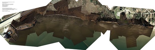
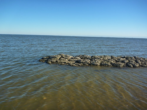
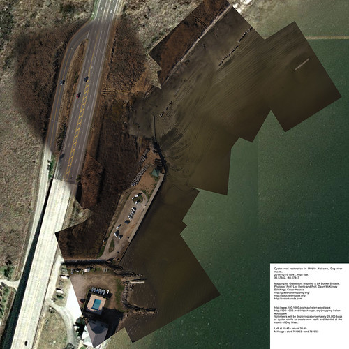
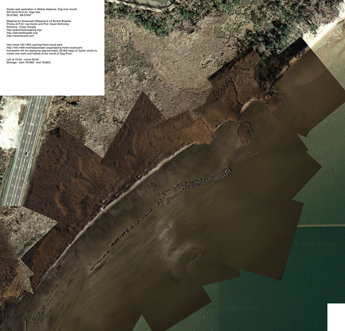
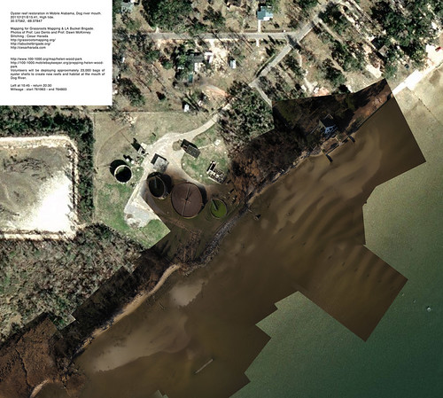
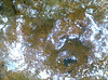
Yesterday we went aerial mapping a landscape that is just about to change radically : restoration of the oyster reef in Mobile Alabama, Dog river mouth – known as Helen Wood Park beach. In two hours from now (2011 January 22 6AM), hundreds of volunteers will come to install a massive oyster reef here. From 8AM today “Volunteers will be deploying approximately 23,000 bags of oyster shells to create new reefs and habitat at the mouth of Dog River” – see them in action here .
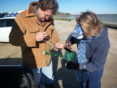
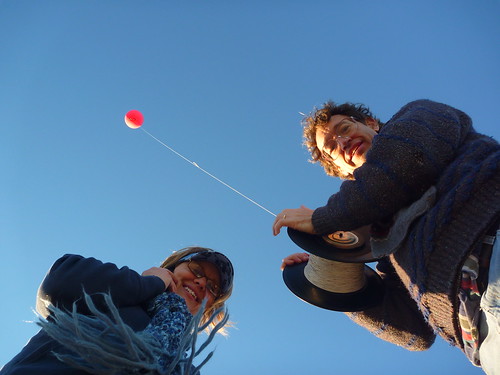
Aerial mapping Prof. Dawn McKinney & Prof. Leo Denton of the University of Mobile South Alabama. Thanks to Shannon Dosemagen for organizing the trip.
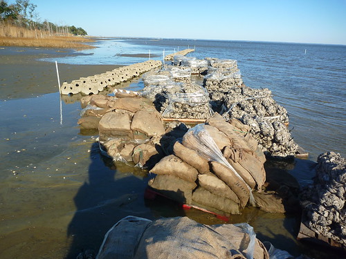
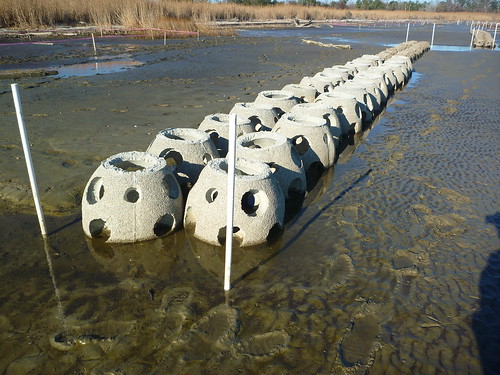
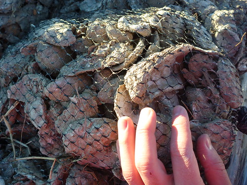
These are the different reefs and bags of oyster they are installing. 5 non-profit organizations are working together to accomplish this massive landscaping project.
We took about 5000 aerial pictures that I turned into 3 very large resolution maps to make one huge map (at the top of the post):
Download these full resolution maps to your computer as .zip file (27mb). If you want to learn how to make one of these map, check this post.
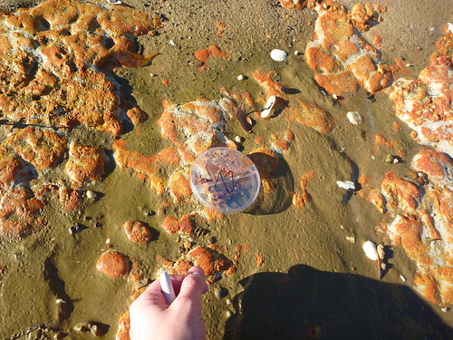
This time, in addition of aerial photography, I also took ground samples (~250x microscopy), sand, sediment, organic material taken at regular interval. The idea is : if we are able to say what is on the ground – sometimes we may find oil spilled still – we can qualify and quantify what we see on the aerial pictures. We will come back in a few weeks to map again and see the effects of installing an artificial oyster reef here : “before and after” 🙂
—
Original blog post : http://cesarharada.posterous.com/mapping-river-dog-mouth-mobile-alabama
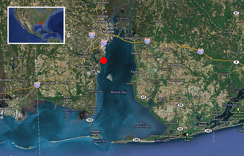
date : 20110121@15:41, low-tide.
Location : 30.57562, -88.07847
Mapping for Grassroots Mapping & LA Bucket Brigade.
Photos : Prof. Leo Denton and Prof. Dawn McKinney
Stitching : Cesar Harada
Left at 10:45 – return 20:30
Milleage : start 761963 – end 764803
Tags: Aerial, Alabama, Balloon, Bottle, Cesar, Dawn, Denton, DIY, Dosemagen, GM, Harada, Jeff, Leo, mapping, McKinney, mobile, Photo, Photography, Prof, Shannon, Soda, South, University, Warren, Yoo
Posted in Blog, syndicated | No Comments »
December 16th, 2009 by Jeffrey Warren
Josh Levinger and I met up with some activists who were planting trees in Umm Salamuna (view in Google Maps) on a hillside which is scheduled to be annexed by a nearby Israeli settlement, and converted into a graveyard. The planting was organized by Alice Gray of Bustan Qaraaqa, so that if the land is taken over, the trees would have to be uprooted or chopped down before the land can be used.. As I understand it, one of the means by which settlements claim land is by using an Israeli law which opens land to new settlement if it has lain fallow for more than three years — so planting the hillside may defend it from such a claim.
The wind was so strong that our first kite, carefully made that morning from dowels and Tyvek, shattered immediately. Instead, we launched a small soft kite with an iPod nano attached to it. Here’s a stitched image of the video footage we captured:
See all the pictures on Flickr.
The iPod has an SD camera which can capture many hours of video – and it’s so super light that we can fly it on a pocket kite. Many of the frames are blurred and the resolution is pretty poor (we’d thought of using a Flip camera but they’re more expensive and heavier) but when you go through the footage frame by frame you can find lots of good images. We then stitched these together with Calico and got the above image. It helped a lot to put a small ‘sail’ on the back of the iPod so it didn’t spin as much.
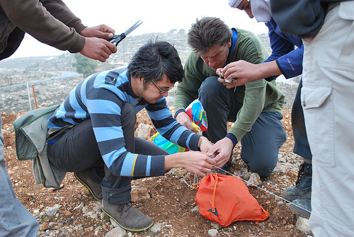
Everyone was cold but once we started flying the kites we all got really excited. The owner of the land was there with his kids and they helped assemble the rig and fly the kite:

The mapping was a big success – everyone ‘got’ why we were doing it, that documenting the tree planting and how they’re changing the landscape is a form of testimony. We’re still working to rectify the imagery, and I’d like to ask folks if they have any ideas – the stitching software we’re using assumes images were taken from a single viewpoint, but the kite and camera were moving all over the place. As you can see above, the stitching distorts things and we lose a lot of detail – how can we reconstruct a high-res image that assumes multiple perspectives? I’m looking at this tutorial to start with. We’re also thinking about an algorithm to dump the clear, undistorted and unblurred frames from a movie file. Ideas?
Cross-posted with Unterbahn.com
Tags: kite, mapping, west bank
Posted in Blog | 2 Comments »


