Grassroots Mapping is a series of participatory mapping projects involving communities in cartographic dispute. Seeking to invert the traditional power structure of cartography, the grassroots mappers used helium balloons and kites to loft their own “community satellites” made with inexpensive digital cameras.

This site has been merged into Public Lab

At Public Lab, we've grown the Grassroots Mapping community into a broader effort to enable communities to understand and respond to environmental threats with DIY techniques.

Read more and join us »

Mapping River Dog Mouth, Mobile Alabama

January 24th, 2011 by Cesar Harada

Giant map_Oyster reef restoration in Mobile Alabama, Dog river mouth_ general map.

Helen Wood Park, Mobile, Alabama, Gulf of Mexico

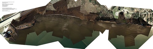
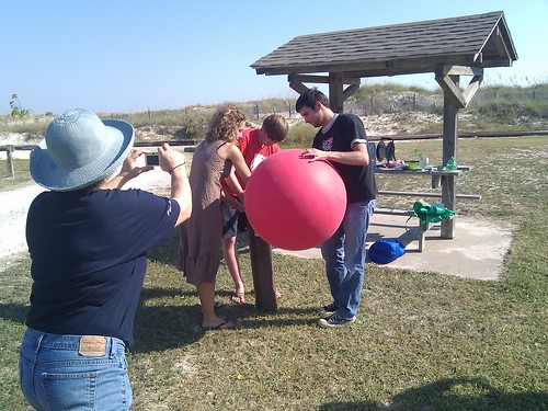
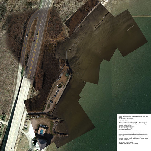
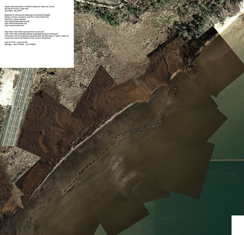
Yesterday we went aerial mapping a landscape that is just about to change radically : restoration of the oyster reef in Mobile AlabamaDog river mouth – known as Helen Wood Park beach. In two hours from now (2011 January 22 6AM), hundreds of volunteers will come to install a massive oyster reef here. From 8AM today “Volunteers will be deploying approximately 23,000 bags of oyster shells to create new reefs and habitat at the mouth of Dog River” – see them in action here .
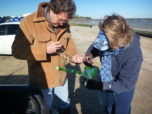
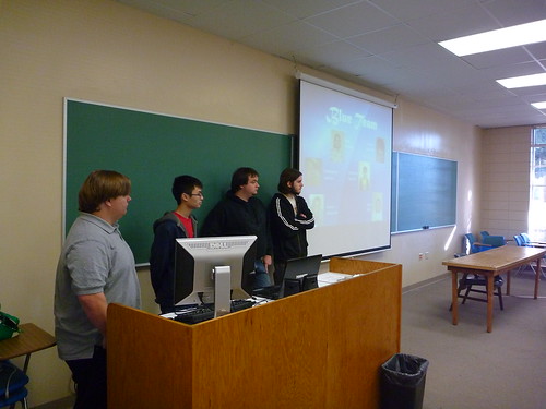
Prof Dawn McKinney & Prof Leo Dento Mapping

Prof Dawn McKinney & Prof Leo Danton & a red balloon
Aerial mapping Prof. Dawn McKinneyProf. Leo Denton of the University of Mobile South Alabama. Thanks to Shannon Dosemagen for organizing the trip.

oyster bags from....

concrete reef

reef at work :)

Oyster bag
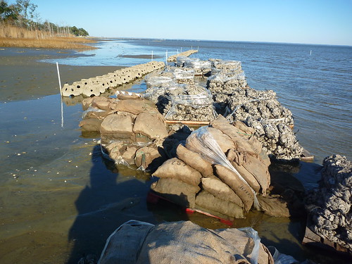
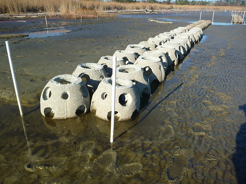
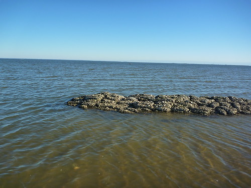
These are the different reefs and bags of oyster they are installing. 5 non-profit organizations are working together to accomplish this massive landscaping project.


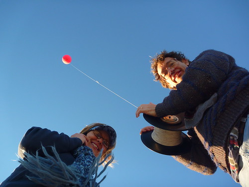
We took about 5000 aerial pictures that I turned into 3 very large resolution maps to make one huge map (at the top of the post):

7000x7000_Oyster reef restoration in Mobile Alabama, Dog river mouth_ south piece.

7000x7000_Oyster reef restoration in Mobile Alabama, Dog river mouth_ center piece.

7000x7000_Oyster reef restoration in Mobile Alabama, Dog river mouth_ north piece.

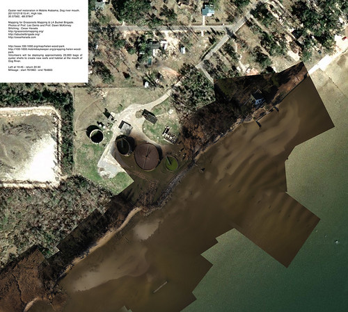
Download these full resolution maps to your computer as .zip file (27mb). If you want to learn how to make one of these map, check this post.

clay sample

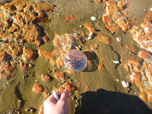
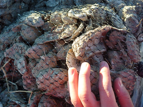
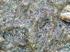
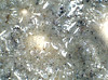
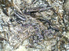
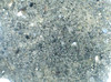
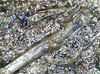
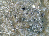
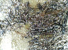
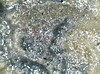
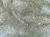
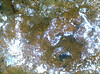
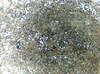
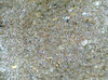
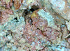
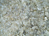
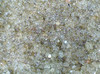
This time, in addition of aerial photography, I also took ground samples (~250x microscopy), sand, sediment, organic material taken at regular interval. The idea is : if we are able to say what is on the ground – sometimes we may find oil spilled still – we can qualify and quantify what we see on the aerial pictures. We will come back in a few weeks to map again and see the effects of installing an artificial oyster reef here : “before and after” 🙂

sample -1, 20110121 Anne Wood Park, Mobile, Alabamasample 1, 20110121 Anne Wood Park, Mobile, Alabamasample 2, 20110121 Helen Wood Park, Mobile, Alabamasample 3, 20110121 Helen Wood Park, Mobile, Alabamasample 3b, 20110121 Helen Wood Park, Mobile, Alabamasample 3b, 20110121 Anne Wood Park, Mobile, Alabamasample 4, 20110121 Helen Wood Park, Mobile, Alabamasample 5, 20110121 Helen Wood Park, Mobile, Alabamasample 6, 20110121 Helen Wood Park, Mobile, Alabamasample 8, 20110121 Helen Wood Park, Mobile, Alabamasample 10, 20110121 Helen Wood Park, Mobile, Alabamasample 11, 20110121 Helen Wood Park, Mobile, Alabamasample 12, 20110121 Helen Wood Park, Mobile, Alabamasample 14, 20110121 Helen Wood Park, Mobile, Alabamasample 15, 20110121 Helen Wood Park, Mobile, Alabama


Original blog post : http://cesarharada.posterous.com/mapping-river-dog-mouth-mobile-alabama
date : 20110121@15:41, low-tide.
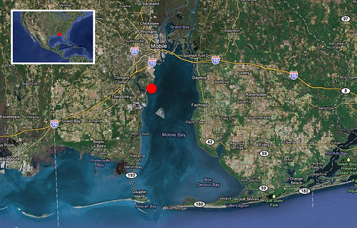
Location : 30.57562, -88.07847
Mapping for Grassroots MappingLA Bucket Brigade.
Photos : Prof. Leo Denton and Prof. Dawn McKinney
Stitching : Cesar Harada
Left at 10:45 – return 20:30
Milleage : start 761963 – end 764803

University of South Alabama oil mapping curriculum

January 10th, 2011 by Cesar Harada

University of South Alabama Student mapping the oil spill and stitching the maps

This post was written by Christopher Johnson, a student at South Alabama University that participated in the Grassroots Mapping project in Alabama.

Hello! My name is Christopher Johnson, and I was one of the University of South Alabama (USA) students to participate in the Grassroots Mapping project in Professor Dawn McKinney‘s Computer Science class. It was a bit weird to go outside and do a project, since our majors are all computer-related, but I think in the long run the class was better for it.

Basically we were broken into teams of around six, each team having at least two of each major: CS, IT, and IS (not our actual majors; we were assigned a major for each third of the course, which we rotated). We had to work in teams to stitch together parts of Dauphin Island using Cartagen, among a few other things essential to the Freshman course.

Most of the technical problems came with Cartagen being down for a short period and unusable pictures – the nice sea breeze can be a difficult adversary. Another difficulty was overcoming the challenges we created ourselves, such as arguments within the group and people not showing up for class.

Overall it was a very good learning experience; I was one of those who went to Dauphin Island (taking the pictures was optional), and we had a lot of fun. I’d definitely do it again, given the opportunity, and I recommend that everybody go out there and try to make a difference. It’s more fun than you think, and you can really make a difference in your community!

Grassroots mapping, inflating balloons, University of south Alabama