PLOTS New York Summit
April 13th, 2011 by Shannon Dosemagen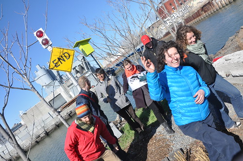
During the weekend of March 25-27, 2011, PLOTS staff – Jeff Warren (Boston), Liz Barry (New York), Shannon Dosemagen (New Orleans), Adam Griffith (Asheville), Mathew Lippincott (Portland), Stewart Long (Oakland) and Sara Wylie (Washington D.C.) – met in New York for the first PLOTS summit. We were able to come together for our first staff meeting due in part to the sponsorship of MITs Center for Future Civic Media.
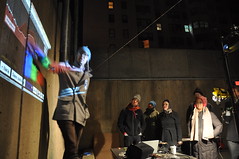
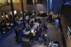
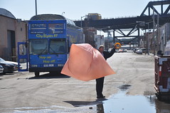
On Friday, PLOTS was invited to teach one of the Trade School classes at the Whitney Museum of American Art – we were easily identifiable with a Mylar balloon floating in the outside courtyard. Despite the cold temperatures, students came to our Make Your Own Spectrometer class where they created spectrometers with paper tubes, CDs, razor blades and tape. Interested in trying out your own or have ideas on how to improve the design? Check out the spectrometer page on the Public Laboratory website. After making spectrometers, students were able to look at water samples collected from the Gowanus Canal and various puddles of standing water from Central Park. Having just released the online spectral analysis tool, students were then given a demonstration on analyzing samples and the first steps in identifying polycyclic aromatic hydrocarbons (PAHs), as this tool is still in development.
Saturday brought a full day of meetings where, amongst other things, we discussed potential upcoming projects including mapping in Salt Lake, Utah and Lome, Togo and decided on creating a website similar to data.gov for all of the images that have been collected on the Gulf Coast and at other sites. We additionally discussed tool curriculum, research goals, incorporating PLOTS into a nonprofit and some of our retail endeavors in the upcoming months – maps, t-shirts and starter kits for mapping. We also decided on a couple of larger PLOTS community events for the next year. The first is what we are calling a “barn raising” where we pick a site that PLOTS team members have been working at and host a 3-4 day workshop where tools are tested in cooperation with community members and others that can help test and solve problems with each tool in use. Potential sites for the 2011 barn raising include Butte, Montana, Grand Isle, Louisiana, and Wiley’s Last Resort in Kentucky. Also in the works is a PLOTS conference with workshops, roundtables and other small sessions for tool and idea R&D. We are looking at early 2012 to host this first gathering.
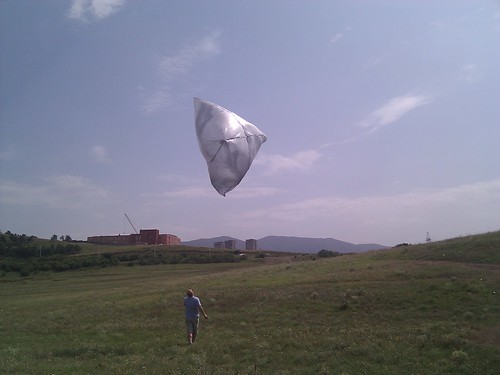
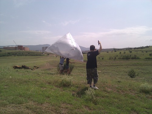
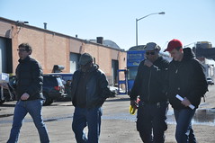
On Sunday, we headed to the Gowanus Canal Superfund site, where we have an active aerial mapping project happening in partnership with the Gowanus Canal Conservancy. One of the difficulties that we’ve experienced with the site is that strong and unpredictable springtime winds have given mappers difficulties as balloons are popped on the barbed wire that lines the heavily industrialized canal. Charles A. Stewart from Let’s Fly Kites came to meet Liz Barry and Leif Percifield who lead the project at Gowanus and as an expert kite flyer, brought a couple of his kites to demonstrate. The new kites that we tested had structure and flew well with the rig attached. Liz and Leif decided on a Delta-Box hybrid model to try out during future mappings of the canal.
What should you look for coming out of this weekend? Lots! And we hope that you all will be active contributors going forward! Next online in the coming month – the first printed maps of the Gulf Coast thanks in part to a sponsorship from Development Seed.