Over the last four months, the Gulf Coast contingency of Grassroots Mapping has been working with the University of South Alabama (USA) School of Computer and Information Sciences. Dauphin Island community member, Leo Denton, introduced us to USA Instructor, Dawn McKinney in September and she requested that we set up a project that would help her freshmen students learn about the process of aerial mapping, project management and using open source software to stitch maps.
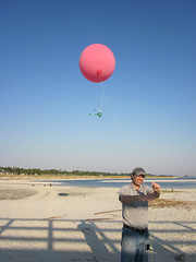
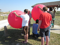
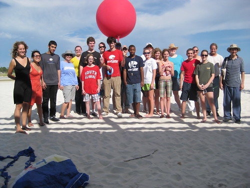
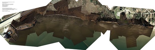
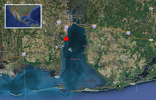
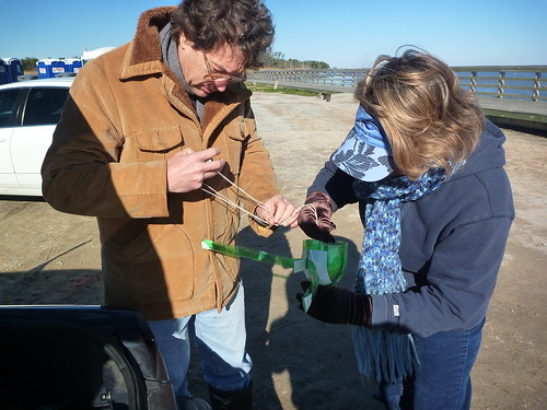
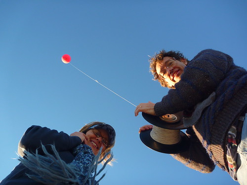
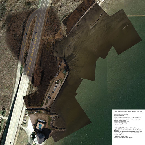
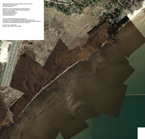
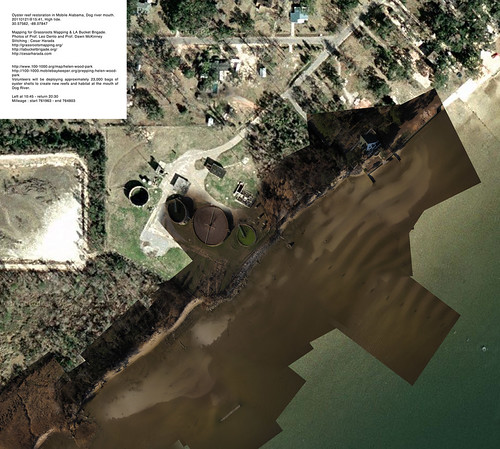
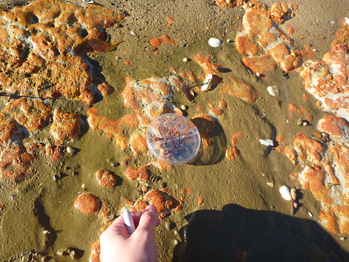
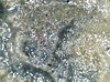
During the first session, Jeff Warren and I gave an overview of the Grassroots Mapping project and Jeff taught the basics of map stitching via Skype from Boston. After this first session, with two volunteers, I accompanied a group of approximately fifteen students and three faculty members to Dauphin Island for a day of service learning where students were to map different portions of the island. Dauphin Island is a particularly difficult location to map as we had experienced over the course of the summer. On the ground there can be hardly a breeze, but upon letting a balloon up only a hundred feet, the wind currents change and you can end up with a balloon floating low to the ground, but half a mile from your standing point. Using the kite was equally difficult, two or three students would act as shadows, making sure that upon catching a rogue air current the kite and camera didn’t dive into the water. Despite the initial difficulties that students experienced, they mapped the island a total of three times, producing enough images to experiment with the stitching process.
From participating in the mapping and learning about Grassroots Mapping techniques, students commented that, “… it gives our communities a chance to fight back,” and, “We were basically able to make our own Google Earth. It made us realize that we don’t always have to rely on companies or what they say. This process gave us the confidence to do things that we might have thought were too complicated or troublesome- you can really do so much with relatively little.”
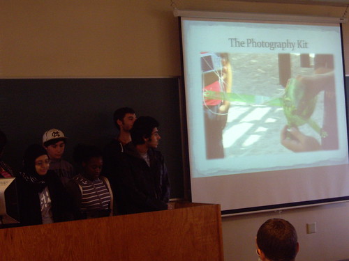
In the classroom, the students used the mapping process as a way to experiment with project management. In each team, students were required to break into the roles of IS, IT and CS, each with different responsibilities. You’ll be hearing from a student in the class on his experience with this project in the next week, but overwhelmingly when students were asked to reflect on what the most powerful take away from this project was, the response was that they not only learned mapping and computing techniques, but skills for working and communicating with a team.
Student teams tackled difficulties that they encountered along the way and even developed suggestions for the Grassroots Mapping team going forward. An initial difficulty that students learned to work around was that the shoreline of Dauphin Island had been completely altered after Katrina, the beach of Dauphin having expanded close to 200 feet. Although Google imagery documented a central pier as being underwater, students quickly identified from memory their local shoreline, noting that it was the same pier that today stands completely inland, out of the water and offers shade on the hot summer days to beach goers.
When the Cartagen site was down for a few weeks, students experimented with different programs that could help them stitch maps including Gimp, Photoshop and Windows Live Photo Gallery. Students favored alternative methods such as the automatic merge function in Photoshop, but were quick to point out the flaws with the different systems that they tried. Some suggested that ease of stitching did not equate to accurate maps, others cautioned their classmates that working in Photoshop was difficult because of the amount of memory that was used in the process. Others even made suggestions about the mapping process including:
– tie two (or even better, three) strings to the balloon to control the movement rather than letting the wind dictate balloon direction,
– When in auto shoot function, count how long it takes for the camera to snap 100 pictures and take GPS coordinates at each subsequent time interval so that there is a more accurate GPS reading (when logging and tracking devices are unavailable),
– Because it is difficult to geographically pinpoint photos where only beach shows, have someone shadow the balloon to take GPS coordinates while walking underneath.
After a positive experience with this project, which was interpreted into computing management practices, USA is interested in continuing this program next semester. From the teaching perspective, Dawn commented that, “…it was wonderful to get out of the classroom and have an experience with my students, it not only gave them a hands on opportunity away from their computers, but also allowed me, as an instructor, to get to know each of them better.” As this was a “pilot” program for teaching Gulf Coast students about the Grassroots Mapping process- from mapping their local areas, to completing final mapped images- over the next few months, we’ll be working on further developing the teaching process for computing students.
Thanks to everyone who helped with this project- all the students, Leo Denton, Dawn McKinney, Cesar Harada, Hunter Daniels and Mariko Toyoji