Grassroots Mapping is a series of participatory mapping projects involving communities in cartographic dispute. Seeking to invert the traditional power structure of cartography, the grassroots mappers used helium balloons and kites to loft their own “community satellites” made with inexpensive digital cameras.

This site has been merged into Public Lab

At Public Lab, we've grown the Grassroots Mapping community into a broader effort to enable communities to understand and respond to environmental threats with DIY techniques.

Read more and join us »

Mapper interview: Kris Ansin

May 20th, 2011 by Jeffrey Warren

Kris Ansin

This part of a series of interviews we’ve conducted with mappers involved in documenting the BP oil spill. It is cross-posted at Public Laboratory

Kris Ansin, of New Orleans, Louisiana

… additional description of his work…

Age: 26, but that’s a little personal 🙂

What locations did you map?

Louisiana, Alabama, Mississippi, New Orleans City Park

What do you do?

I am an MPH candidate at Tulane in the Department of International Health and Development and work as a research assistant within the department. Outside of the classroom and the cubicle, I spend time with my dog, running, reading, and playing scrabble

How did you become interested in Grassroots Mapping?

Through working with Tulane and LABB on GIS and mapping

What was your most memorable experience while leading a trip?

Trying to map by myself on a kayak

Any suggestions for future trip leaders or Grassroots Mapping in general?

Take Nathan Morrow’s next GIS class (Tulane University)

Why do you think mapping the spill is an important environmental monitoring technique?

Great way for anybody- school, communities, to get involved in the protection of their communities

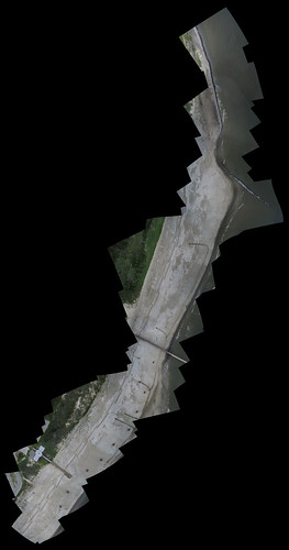
Below is a map based on one of Kris’ trips, of Grand Isle State Park in Louisiana:

may-19-grand-isle-state-park-LA

PlayPhilly launches balloon in Philadelphia to observe public space usage patterns

May 17th, 2011 by Jeffrey Warren

Project: Grassroots Mapping from PlayPhilly on Vimeo.

Giacomo Ciminello of PlayPhilly writes:

Hello everyone, I wanted to pop in to answer any questions on the project. Yes, we used Photosynth as a quick and dirty method to stitch everything together. The project started as a means to use playful tools to get the public to stop and engage in public space more. This method really got people around the city talking. A couple even left their buildings and chased us down to see what we were up too. Fantastic experience overall. So many great stories. But if you would like to check out the Synths go here..

Photosynth 1
Photosynth 2
Photosynth 3
Photosynth 4

All of these flights were during peak office hours, and in the most occupied downtown district of Center City. yet, there are no people. The spaces go unused, and give the downtown landscape a sense of loss
and isolation. This could in theory translate to the un-innovative nature of the workforce here. The theory being that by using playful acts people get re-energized as the spaces do. The city recognizes its horrible planning and plans on spending upwards of 90 million to fix just one of these spaces. We spent $100 and got people talking. We hope to continue using this method to open the dialog between the people of downtown Philly, and city planners so that city resources get put to the appropriate use and that the public can have a voice.

More photos and documentation »

And photos on Flickr:

PlaceMatters launches a test balloon with an iPhone attached

May 4th, 2011 by Jeffrey Warren

iPhone Balloon Launch from PlaceMatters Videos on Vimeo.

This post is re-posted with permission from the PlaceMatters.org blog. The author, Ken Snyder, is the Executive Director of PlaceMatters.

Ken writes: At the GeoDesign conference in San Diego we heard mention of folks at MIT using helium balloons with cameras attached to take aerial pictures. Thinking this was a fabulous idea I decided to find out more and see if this was a technique we could easily incorporate into our projects.

The MIT connection turned out to be the MIT Center for Future Civic Media and their partnership with others to create Grassroots Mapping, a project and resource site to encourage citizens to use these balloons to generate maps of communities and their surrounding environment.

One application highlighted on the website is Gulf coast communities using the balloons to observe and report on last year’s BP oil spill. From Grassroots Mapping emerged the Public Laboratory for Open Technology and Science (PLOTS) which represents network of scientists and activists experimenting with accessible technologies for investigating and reporting on local environmental health and justice issues. PLOTS is a great example of an online platform bringing together citizens, scientists, social scientists, and technologists to collaboratively solve problems.

We too see a number of ways we could integrate balloon launches into our work including adding a bird’s eye perspective to our Walkshops or providing a unique medium for place-based art projects. The 3 minute video at the top of this blog documents our first balloon launch. Grassroots Mapping’s downloadable instructions on how to build your own helium balloon camera made the job easy.

At the time, we did not have a digital camera with the functionality of taking continuous pictures so I put huge faith into our knots and fishing line and sent up my iPhone in video mode. Since then we have acquired a GoPro sports camera that is capable of taking video or time-lapse pictures. The GoPro has the added advantage of having a wide angle lens. Total cost for our first balloon launch was $165, with the rental of the helium tank and the purchase of a 6 ft diameter balloon being the dominant expenses. The tank had enough helium for two launches.

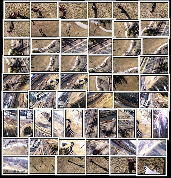
Here is a poster of some of the images extracted from the video.

Grassroots Newark Continues

April 7th, 2011 by jen.hudon

Grassroots Newark: Phil Silva wrangling the balloon from Jennifer Hudon on Vimeo.

As follow up to a November 2010 camera launch, a group of  11 students, professors and community members gathered on Saturday, March 5th for the second installment of Grassroots Newark. The dual purpose of the project is to (1) document the progress of the development of the riverfront park being built along Raymond Boulevard in Newark, NJ and (2) use the site space to teach people about grassroots mapping while testing new processes by innovating balloon, kite and camera designs.

The group constructed a three-mylar sack balloon with an arch and long tail – modeled after a design used for Gowanus Canal in January. While the sun was out and we had a beautiful day, the wind speeds were too high for a successful launch. Simultaneously, a couple people in the group attempted to fly a kite, but were unable to get it to stay level and high enough for an extended period of time.

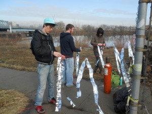
Thus, we only accomplished one of the two set goals and ended up having a great time outdoors with our way-too-powerful balloon. Additionally, we saved the tail the Eugene Lang students (above) made and will use it again.

For next steps, we plan to meet again on April 16th with a new design that can maintain its shape without ripping the mylar while withstanding higher wind speeds. Other learning points to took away, were to (1) start much earlier in the morning when wind speeds are lower, (2) try to have the entire balloon constructed before working in the field, and (3) find additional tasks to keep all volunteers busy throughout the duration of the site work.

Western Carolina University students map on the SC Coast

March 15th, 2011 by Adam Griffith

During the first week of March, students enrolled in Dr. Rob Young’s field trip course at Western Carolina University attempted to map coastal wetlands using Grassrootsmapping techniques in Beaufort County, SC. Beaufort County, SC has the most coastal wetlands of any county on the US East Coast and these wetlands are being threatened by sea level rise. Specific vegetation grows in high marsh and low marsh and an aerial view of the wetlands makes distinction of the two easier than ground based techniques.

Weather conditions during the week were very poor for balloon mapping due to 30 MPH sustained winds over two days. On the morning of the third day, seemingly calm conditions coaxed us into action, but the upper level winds carried the balloon horizontally more than vertically. We launched our Sutton Flowform 16 kite an hour later and gusts caused the Picavet suspension to swing wildly around the flying line. Some interesting images resulted.

This experience represents a core challenge of GRM techniques: weather conditions may not cooperate during the narrow time of a visit making the challenge of capturing imagery of a specific area even greater. This mission was a teaching students the basics of low cost aerial mapping, and was therefore a success, however, the imagery collected is not able to be stitched into a map of the wetland. This site is about a 6 hour drive from our university, so for future missions with the goal of mapping wetlands, we must better cope with the variable conditions.

Corey from Windpower Sports in Las Vegas (baby) suggested the following:
• Put the picavet suspension 100 ft away from the kite instead of our 50 ft.
• Use a Y shaped tail at least two times the length of the kite with a spinner sock on the end
• Use heavier weight flying line to stabilize from the front end of the kite
• Use a different kite with different ideal wind ranges
• Increase the weight of the camera

Mapper interview: Dawn McKinney

March 9th, 2011 by Jeffrey Warren

Dawn McKinney

This is the first of a series of interviews we’ve conducted with mappers involved in documenting the BP oil spill. It is cross-posted at Public Laboratory

Dawn McKinney, of Mobile, Alabama
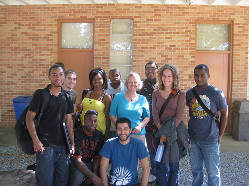
(pictured above center in blue shirt)

What locations did you map?

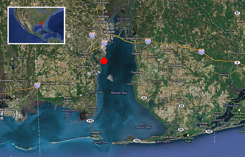
Dauphin Island, a barrier island off the coast of Alabama at the mouth of Mobile Bay, near the former “Sand Island” and the public beach and Helen Wood Park in Mobile Bay.

What do you do?

I am a Senior Instructor in the School of Computer and Information Sciences (CIS) at the University of South Alabama in Mobile. I teach the object-oriented programming course for Computer Science majors and the Freshman Seminar course for all incoming freshmen to the School of CIS. I am also Co-Director of South Alabama’s Center for Academic Service-Learning and Civic Engagement and on facebook.

How did you become interested in Grassroots Mapping?

I got involved in discussions about the Gulf Oil Spill Disaster and was made aware of this opportunity for the freshmen students to participate in a semester-long project where they could work in teams to explore their majors, establish relationships with other students, and connect to their community.

What was your most memorable experience while leading a trip?

Walking along the shore of the Gulf of Mexico with students and getting to know them away from the classroom.

Any suggestions for future trip leaders or Grassroots Mapping in general?

Pay more attention to the wind conditions in order to plan for problems better. Plan enough trips on varied dates and times which give all students an opportunity to participate. Have at least 3 trips throughout the semester. Give the students a “final goal” to reach so they have something to shoot for and so they know when they have succeeded. Give the students more background information about the environment in which the mapping is taking place and have them reflect more on the purpose, benefits of the experience for both the students and the environment.

Why do you think mapping the spill is an important environmental monitoring technique?

It gives every day people an opportunity to participate in something which could have a large impact on the community. It also connects people and at least gives them an awareness of their environment and how it changes. Probably most important is that it empowers every day people.

Anything else?

GM was an incredible resource for us and did an outstanding job of working with the students.

Finding commercial satellite imagery

February 7th, 2011 by Jeffrey Warren

A friend asked me to help find good imagery of the Oil Rocks near Baku in the Caspian Sea, which is not visible in Google Maps. In this 10 minute tutorial, I walk through the process of looking in Google Historical Imagery, then browsing and pricing out commercial satellite imagery from various vendors based on resolution, recency, and coverage.

The expense and difficulty of finding many sites in the world is exactly the inspiration for Grassroots Mapping, but in many cases this can be a useful (if somewhat esoteric) process to be familiar with. It’s also a great thing to check before attempting a balloon mapping flight — even if only to see what is available and how much cheaper producing your own imagery might be.

Obtaining base data for aerial image georeferencing and rectification

January 24th, 2011 by Stewart Long

One possible way to process raw aerial imagery is to use existing imagery for georeferencing and rectification. With this technique it is possible to process aerial imagery without GPS data. The base data must have good metadata with a known coordinate system. It is also important to be aware that the precision of the new map will reflect the level of precision of the base data.

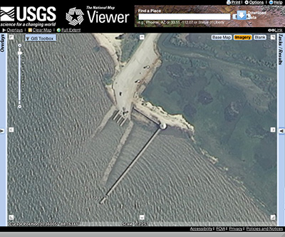
It is possible to obtain base data for the area of interest from various online GIS data clearinghouses. The USDA National Agriculture Imagery Program (NAIP) is a 1m leaf-on coverage of the entire conterminous U.S. The imagery is acquired by the USDA and then made available to the public through the USGS National Map Viewer. It represents an excellent baseline for obtaining public domain base data for image processing.

http://nationalmap.gov/viewers.html#

Download by either navigating the viewer extent to your area of interest, or through a bounding box query.

Mapping River Dog Mouth, Mobile Alabama

January 24th, 2011 by Cesar Harada

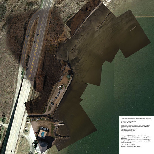
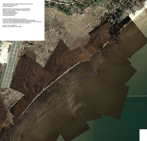
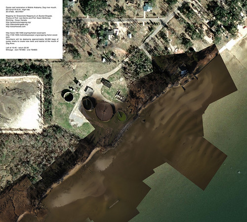
Giant map_Oyster reef restoration in Mobile Alabama, Dog river mouth_ general map.

Helen Wood Park, Mobile, Alabama, Gulf of Mexico

Yesterday we went aerial mapping a landscape that is just about to change radically : restoration of the oyster reef in Mobile AlabamaDog river mouth – known as Helen Wood Park beach. In two hours from now (2011 January 22 6AM), hundreds of volunteers will come to install a massive oyster reef here. From 8AM today “Volunteers will be deploying approximately 23,000 bags of oyster shells to create new reefs and habitat at the mouth of Dog River” – see them in action here .

Prof Dawn McKinney & Prof Leo Dento Mapping

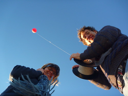
Prof Dawn McKinney & Prof Leo Danton & a red balloon
Aerial mapping Prof. Dawn McKinneyProf. Leo Denton of the University of Mobile South Alabama. Thanks to Shannon Dosemagen for organizing the trip.

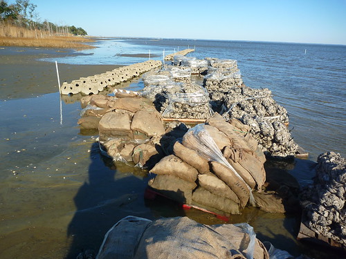
oyster bags from....

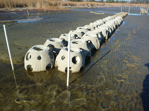
concrete reef

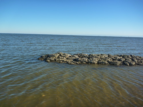
reef at work :)

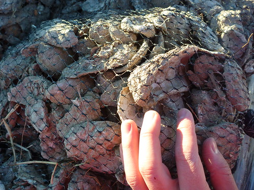
Oyster bag
These are the different reefs and bags of oyster they are installing. 5 non-profit organizations are working together to accomplish this massive landscaping project.


We took about 5000 aerial pictures that I turned into 3 very large resolution maps to make one huge map (at the top of the post):

7000x7000_Oyster reef restoration in Mobile Alabama, Dog river mouth_ south piece.

7000x7000_Oyster reef restoration in Mobile Alabama, Dog river mouth_ center piece.

7000x7000_Oyster reef restoration in Mobile Alabama, Dog river mouth_ north piece.

Download these full resolution maps to your computer as .zip file (27mb). If you want to learn how to make one of these map, check this post.

clay sample

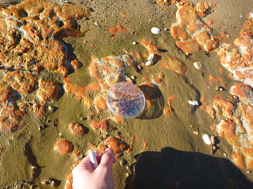
This time, in addition of aerial photography, I also took ground samples (~250x microscopy), sand, sediment, organic material taken at regular interval. The idea is : if we are able to say what is on the ground – sometimes we may find oil spilled still – we can qualify and quantify what we see on the aerial pictures. We will come back in a few weeks to map again and see the effects of installing an artificial oyster reef here : “before and after” 🙂

sample -1, 20110121 Anne Wood Park, Mobile, Alabamasample 1, 20110121 Anne Wood Park, Mobile, Alabamasample 2, 20110121 Helen Wood Park, Mobile, Alabamasample 3, 20110121 Helen Wood Park, Mobile, Alabamasample 3b, 20110121 Helen Wood Park, Mobile, Alabamasample 3b, 20110121 Anne Wood Park, Mobile, Alabamasample 4, 20110121 Helen Wood Park, Mobile, Alabamasample 5, 20110121 Helen Wood Park, Mobile, Alabamasample 6, 20110121 Helen Wood Park, Mobile, Alabamasample 8, 20110121 Helen Wood Park, Mobile, Alabamasample 10, 20110121 Helen Wood Park, Mobile, Alabamasample 11, 20110121 Helen Wood Park, Mobile, Alabamasample 12, 20110121 Helen Wood Park, Mobile, Alabamasample 14, 20110121 Helen Wood Park, Mobile, Alabamasample 15, 20110121 Helen Wood Park, Mobile, Alabama


Original blog post : http://cesarharada.posterous.com/mapping-river-dog-mouth-mobile-alabama
date : 20110121@15:41, low-tide.
Location : 30.57562, -88.07847
Mapping for Grassroots MappingLA Bucket Brigade.
Photos : Prof. Leo Denton and Prof. Dawn McKinney
Stitching : Cesar Harada
Left at 10:45 – return 20:30
Milleage : start 761963 – end 764803

Western Carolina University students map campus

December 12th, 2010 by Rachel Phipps

Mission

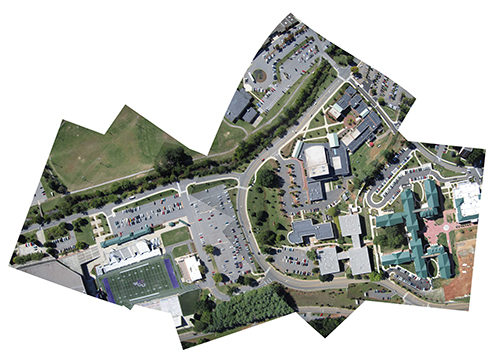
A group of students attending Western Carolina University, under the guidance of Adam Griffith, took on the project of mapping the campus using aerial photography in the fall of 2010. The project was initiated because there was concern about the Google Earth images that covered the campus and the surrounding Cullowhee area. Satellites for Google Earth images only pass by every couple weeks and our campus is experiencing lots of change through construction of new buildings and new facilities that Google Earth does not reflect. Also, the images are of extremely poor quality, and unless you are familiar with the campus it is difficult to discern cars and some buildings and small structures.. This is where we come in: our images taken only 1000 feet in the air are of much better quality and clarity than those in Google Earth, and when we complete the project we would love for Google to insert our images into their maps.

WCU students pull in a balloonWCU material

Process

The photographs were taken by suspending a camera inside the top of a 2 liter soda bottle and attaching this setup to a 250 gram balloon which was on 1000 feet of string (see materials picture d). We also used the same soda bottle-camera rigging attached to a kite to test which produced better photos (balloon). The balloon was pulled by hand by students on the ground and was navigated around campus, making sure to steer clear of tall buildings, trees, and other high objects that could snag the string. The camera was 14 megapixels and was set on continuous mode so it would take about a picture per second while up in the air. After several flights, we discovered what conditions were most suitable to our endeavor. The best photos were taken when the sun was out with no clouds in the sky. Lights winds were fine, but heavier winds caused the balloon to be jerked around, which would not allow the camera to focus. Advice for other mappers would be that no matter what equipment you use to take your aerial photos, make sure it is sturdy enough to withstand a fall! We experienced a malfunction where the balloon burst while we were pulling it in, and the camera struck pavement roughly. Luckily it survived with little to no damage.

WCU map

Stitching

When first reviewing the outline of the project, stitching the photos together to form the map seemed like a simple enough task. We found out otherwise. The photos chosen had to be almost completely straight down and in focus on the area being photographed in order for them to be properly stitched together to fit Google Earth. Because the camera was in so much motion while in the air, there were very few pictures that turned out to be completely straight down. Due to this fact, we had to warp several photos when they were stitched and manually force them to mirror Google Earth. Stitching these photos turned out to be the most difficult and time consuming task for the whole project. However, our end product was such an improvement over Google Earth that the effort was worth it. Our photos had about 7cm resolution or 7 cm per pixel, which is a vast difference from Google Earth.