Mapper interview: Kris Ansin
May 20th, 2011 by Jeffrey Warren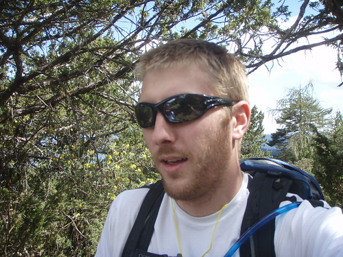
This part of a series of interviews we’ve conducted with mappers involved in documenting the BP oil spill. It is cross-posted at Public Laboratory
Kris Ansin, of New Orleans, Louisiana
… additional description of his work…
Age: 26, but that’s a little personal 🙂
What locations did you map?
Louisiana, Alabama, Mississippi, New Orleans City Park
What do you do?
I am an MPH candidate at Tulane in the Department of International Health and Development and work as a research assistant within the department. Outside of the classroom and the cubicle, I spend time with my dog, running, reading, and playing scrabble
How did you become interested in Grassroots Mapping?
Through working with Tulane and LABB on GIS and mapping
What was your most memorable experience while leading a trip?
Trying to map by myself on a kayak
Any suggestions for future trip leaders or Grassroots Mapping in general?
Take Nathan Morrow’s next GIS class (Tulane University)
Why do you think mapping the spill is an important environmental monitoring technique?
Great way for anybody- school, communities, to get involved in the protection of their communities
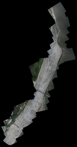
Below is a map based on one of Kris’ trips, of Grand Isle State Park in Louisiana: