Grassroots Mapping is a series of participatory mapping projects involving communities in cartographic dispute. Seeking to invert the traditional power structure of cartography, the grassroots mappers used helium balloons and kites to loft their own “community satellites” made with inexpensive digital cameras.

This site has been merged into Public Lab

At Public Lab, we've grown the Grassroots Mapping community into a broader effort to enable communities to understand and respond to environmental threats with DIY techniques.

Read more and join us »

Continued kite-flying and paper mapping

January 21st, 2010 by Jeffrey Warren

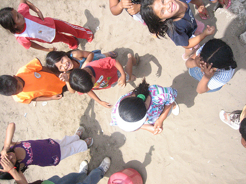
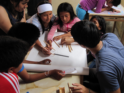
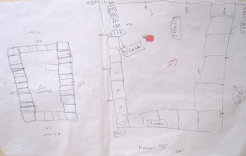
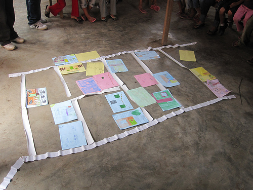
Quick update – we’re continuing to fly kites and take pictures but we’re waiting for our ‘perfect day’ of kite flying… so far we’ve had a rough time with the wind and haven’t yet gotten the cameras high enough to take an overall picture. But we’re trying again Saturday in Juan Pablo II. Above, we asked the kids to draw pictures of their houses, and as a group activity, we organized them into a map to get a better idea of how the community is shaped.

Tomorrow I’ve been invited by some activists and artists I met at Escuelab to come out to a community called Cantagallo in the center of Lima, where an entire community from the Amazon region of Peru has relocated as a block to the bank of the river Rimac. They’re doing a project there and are really excited about making a map – and the community is looking to establish legal tenure. Perfect! I’ll post some pictures on Saturday.

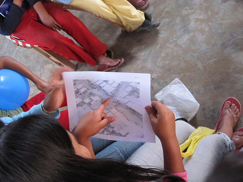
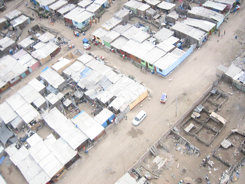
Below, Sandy from CEDRO examines an aerial photograph we took last Thursday. Since the Google imagery, the residents of Juan Pablo II have added an entirely new street, and completely reorganized their homes… the Google map is badly outdated.

Initial Map Warper test with kite imagery

January 16th, 2010 by Jeffrey Warren

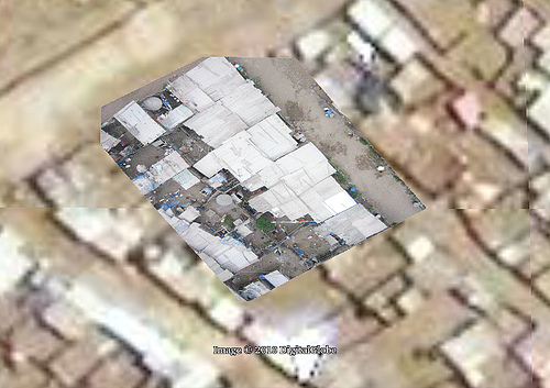
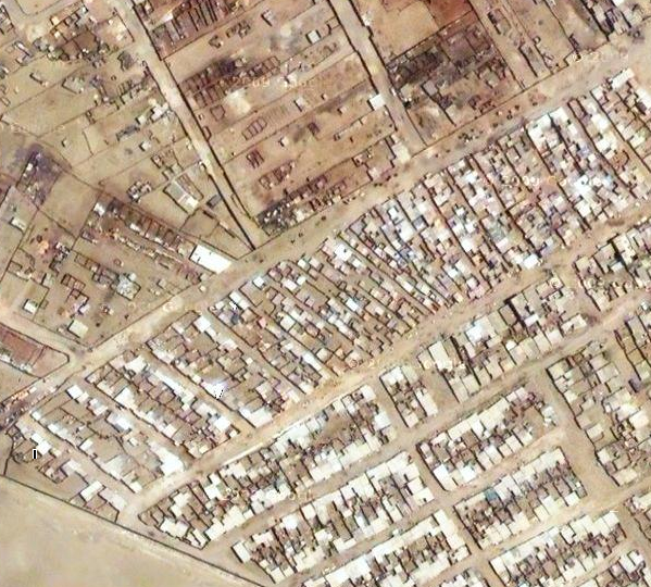
We’re working to process and rectify all the imagery we captured on Thursday, but here’s an initial attempt at rectifying an image. I must admit I was initially discouraged that the Google map seemed pretty decent (it’s supplied by DigitalGlobe) but now that I’m trying to actually rectify images against it, it’s really almost unusable!

I can’t see any useful detail, and almost all of the houses have moved or changed… about one in a hundred roofs match up, making it very difficult to rectify. I think we need one really good very high altitude shot to fix our overall layout, then we can rectify the lower altitude, higher detail imagery. We’ll try Tuesday afternoon.

Mapping with balloons, kites, and kids – first flights with Juan Pablo II in Lima

January 15th, 2010 by Jeffrey Warren

Yesterday Seth Hunter and I had our big flight with teachers from CEDRO and Manzanita “A” and the kids from invasion Juan Pablo II, and everything went extremely well. We started by reviewing the Google Maps imagery of the area (see previous post) and discussing their new homework project of writing about the history of the community, when their family arrived and from where, etc. (see the full homework on the Grassroots Mapping wiki). This was put together with the team from CEDRO — Ernesto, Sandy, Sara, and others, whose fantastic work and thorough understanding of the kids we’re working with has made this all possible. I’ve been very impressed with their personal commitment to the community – they know all the kids and their families, and have a very good rapport with the residents of Juan Pablo II.

After a short discussion of the camera rig and some helium safety tips/rules, we set out to launch our first balloon – or rather 5 balloons, which is what it took to launch our camera.

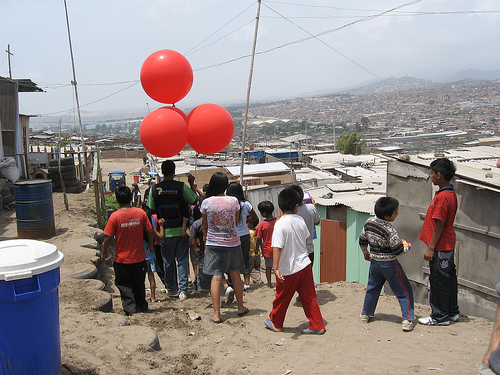
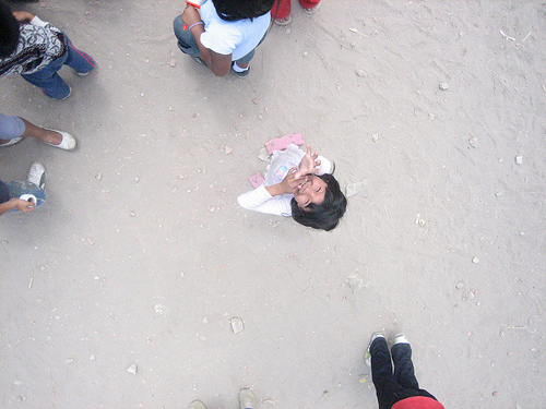
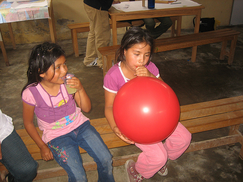
However, there was quite a bit of wind, and things got a bit turbulent. The rig kept getting pushed down by gusts, and with all the DIY electrical wiring around, we told the kids to let go of the string for a bit. Ultimately, though, we had a big crowd, and the kids helped with everything from filling balloons to tying the rigging — and most importantly, they had a ton of fun.

We were unsure about the pictures we’d get, and indeed we didn’t really get high enough with the balloons (see above) so later, with a smaller group of kids we tried flying kites, which worked fantastically – we got the camera up quite high and captured some really good imagery which we hope to rectify later today or tomorrow. To produce a complete map, we expect to repeat kite/balloon flights over the next week or so.

All in all, the day went terrifically well; many thanks to the aforementioned members of CEDRO as well as Carla del Carpio and Nancy, who were also there to participate.

The complete set of photos of the event are being uploaded to Flickr under the tag “grassrootsmapping”.

Juan Pablo II on Google Maps

January 15th, 2010 by Jeffrey Warren

Here’s Juan Pablo II (as far as I can tell) on Google Maps. (Link here)

It doesn’t look so bad in fact… we’d expected older imagery. But the detail is not quite good enough to make out which homes are which, and there are no labels or anything, so it’s quite hard to figure out where you are. We’ll see how these sync up with the higher resolution balloon imagery we capture… hopefully tomorrow!

First day of mapping in invasion Juan Pablo II, in Lima, Peru

January 13th, 2010 by Jeffrey Warren

Yesterday we had our first mapping session with the kids from Juan Pablo II, the invasion we’re working in. Carla took Seth and I up to Villa el Salvador, and after walking around a bit to get oriented, we met up with Ernesto, Sandy, Sara, Nancy, and Johann, who are doing the project with us. We spent some time gathering kids up (quite a few had to work today, so we had a smaller class of about 8), and then got right down to drawing maps. The kids enjoyed debating where they lived and how far away, and we ended up with a nice map that was not so literal, but got them oriented a bit and in the mapmaking mind-set.

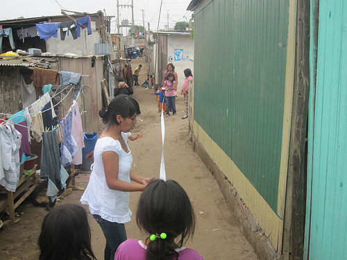
Then the others had a great idea, and we all set to making some long tape-measures from some large sheets of 1 inch graph paper. This took a while but the kids were very efficient and we broke into groups of 2-3 to measure some of the ‘manzanas’ or blocks that the homes are divided into.

Each block has about 10-15 homes, and we measured them to the inch! It’ll be fun to see how these hand-measured maps match up to the aerial pictures we hope to take.

The kids got all tired out and to tell the truth, so did the adults. We finished up with the kids and then had a wrap-up meeting where we talked about scheduling the next few classes, discussed what worked and what didn’t (the kids seemed to lose interest in measuring things after about 20 mins or so… especially as it got towards lunchtime) and planned out some more activities. We hope to do a balloon launch on Thursday, but we’ll see how the weather looks.

Anyways thanks to everyone who participated for a fantastic and gratifyingly exhausting first day! Seth and I are posting more photos on Flickr.

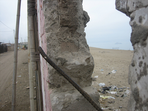
Here’s a great picture of the wall at the edge of the invasion which separates the community from the ocean:

Possible legal role for grassroots mapping in Lima

January 10th, 2010 by Jeffrey Warren

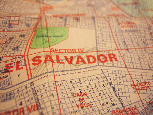
Today I met with Ysabel, Carla, and Nancy, and reviewed the month-long mapping project plan. The meeting went well; all three are excited about the project and we agreed to meet Tuesday morning to head out to Juan Pablo II, the first invasion (what they call the settlements here) we’ll be working in, where we’ll meet CEDRO partner Ernesto, and the kids we’ll be working with. See the “blank spot on the map” above, where Carla and Ysabel sketched in the invasion.

We also identified several potential mapping sites, and they told me that in order to be recognized, inhabitants of invasions are required to submit a map of the area they are claiming, signed by an architect or civil engineer, to the government of Lima. They seem to think that the maps we produce will be accepted, and that the signature is just a formality. I hope this is true; I was prepared to accept that we’d only use the maps as planning tools and as an exploratory process for residents, but I’d secretly hoped that we could play some role in the invasion legitimization process as well. It now seems like that may be possible.

Grassroots Mapping at the Royal Scientific Society of Jordan

January 10th, 2010 by Jeffrey Warren

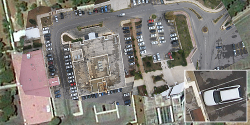
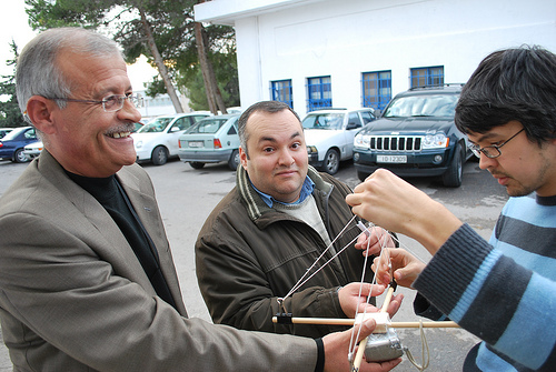
(Cross-blogged at the Center for Future Civic Media dev-blog) Following up on our trip to the West Bank, Josh Levinger and I were hosted by Edward Jaser of the RSS in Amman to demo some grassroots mapping techniques. Ed was a fantastic host (thanks again!) and has sent in the following summary on the experiments we did. Note in the above picture the absolutely fantastic resolution we got (click for full size) as opposed to the standard Google imagery at the edges of the picture.

It all started when the “Innovations in Mobile Data Collection in the Middle East” event took place in Amman from 8th Dec. to 10th Dec 2009. There was an interesting presentation on low-cost mapping techniques and many people showed interest in the subject. There was excitement among participants regarding a plan to do a live demonstration experiment on low cost mapping during the event. However, a big balloon equipped with a camera flying in the sky of Amman is (I think) an unprecedented event and the organizers and I were not sure about the reaction to this — and we were not sure how to get the necessary approval, or if that were even possible.

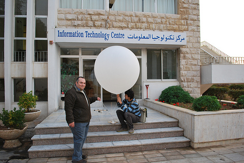
I work for the Royal Scientific Society (RSS) which is a research institute in Jordan and it has a large and protected campus. I thought we could have a bit of privacy and freedom to conduct the experiment within the campus so we decided to give it a try. Jeff and Josh kindly visited the RSS on Monday, December 14th to conduct, I believe, the first low-cost mapping experiment in Jordan.

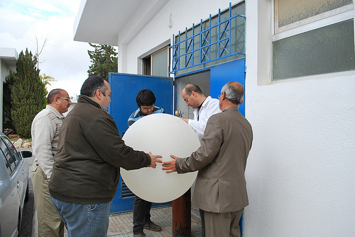
One issue was to find helium for the balloon. I have never shopped for helium before (I never thought I would) and I didn’t have the slightest idea where to get it from. We thought of going to a flower shop and asking there. We asked my colleagues about a nearby shop and one colleague suggested we first ask the Industrial Chemistry Center at the RSS if they have helium. Luckily, and surprisingly, the center had plenty of helium and it also had friendly staff and so we managed to get the balloon filled (for free).

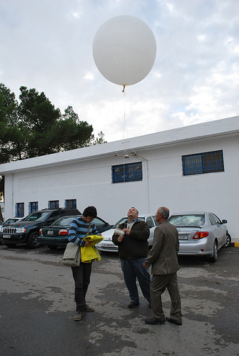
We were extremely lucky with the weather and the wind and so the conditions were just perfect. It was quite interesting watching Jeff and Josh equip the balloon with the camera and calibrating the movement mechanism and they were generous in explaining the steps. Finally the balloon started rising elegantly above the RSS to reach the needed height — approximately 500 feet. We walked around the campus and navigated the balloon to cover as much as possible from the RSS, during which we had to answer questions from many curious people who were wondering what on earth we are doing with the balloon.

Finally, the journey of the white balloon above the RSS came to an end and we were excited to see the outcome. Without a doubt, the data collection part of the experiment was a great success and most of the images we got were fantastic. Jeff and Josh demonstrated how to use the open source Map Warper to upload images and rectify them against a map. What we ended up with was many times better than what is available on Google Earth.

For few days after the experiment and I was still getting phone calls from people asking about the white balloon above the RSS. I showed the excellent result we got to some students and researchers at the university I lecture in, and there is great interest now to repeat the experiment.

See all the pictures here: Grassroots Mapping at the RSS on Flickr, and many thanks to the Map Warper team for their fantastic tool!

Landed in Lima, found helium

January 8th, 2010 by Jeffrey Warren

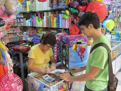
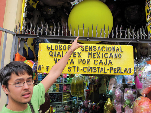
Seth Hunter and I landed in Lima Wednesday morning at about 7am, and after resting up a bit, we set out to find some helium for the planned grassroots mapping workshops. A cab driver took us to the Centro de Lima, to Calle Japon (more or less Chinatown) where a lot of party stores can be found. After asking around a bit, we found ourselves in a galeria called Dorado, in which several vendors had large tanks of helium.

After some negotiation we managed to buy 2 small pink tanks of helium which are single-use, for 96 soles each, or about US$34. Some ‘math’ tells me this will fill a single 5-foot diameter balloon, or several 3-foot balloons. This is about double the price of helium in the US, but not prohibitive. If we want to save money, we should lighten the payload so it fits on a single 3-foot balloon, which incidentally is sold here in Lima also, for 36 soles, or about US$13 each.

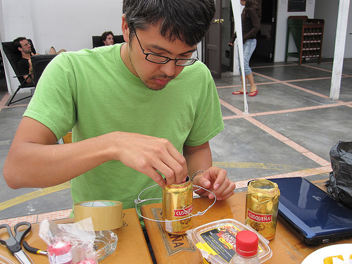
We’re also prototyping a hot air balloon design (using some guides we’ve found and put on the wiki) and should do a first flight test today. The candles we bought were too weak so we’re trying to buy some Sterno (no luck yet) and may try a beer-can alcohol stove today. I’m dubious about fire safety with airborne fire over a neighborhood with no fire department… but Sterno should be safe, and a small alcohol stove using low concentration rubbing alcohol… we can at least test it here by the hostel and see what the risks are.

We also set up a meeting on Sunday with Ysabel and Carla, friends of mine (Carla works with CEDRO, our partner organization here in Lima) and Hector from Bruce Peru, as well as Ernesto from CEDRO. Hopefully we’ll figure out a working schedule and generally get people excited about the project.

Kite-video generation of aerial imagery

January 7th, 2010 by Jeffrey Warren

(Cross-blogged with Unterbahn.com)

The day after working with landowners and activists in Umm Salamuna in the West Bank, we stopped by to visit Alice Gray, who organized the protest. She runs a permaculture farm project in Bethlehem called Bustan Qaraaqa, and was interested in mapping the farm periodically to monitor growth and erosion. She was quite excited about the kite concept so we thought we’d give it a try.

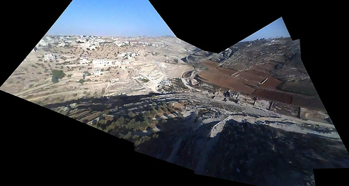
The attempt was somewhat frustrating – while the day before we had over 30mph winds, at the farm we had the opposite problem: very little wind. BQ is located in a sharp valley where it’s hard to get a view from above (see picture) but we finally managed to loft a small parafoil kite (thanks Nadya!) with an iPod nano attached. We let it out about 500 feet, but the kite flew at a very low angle, and in the wrong direction. In the end we got a reasonable image of the other side of the valley, which we’ll try to rectify as a proof of concept.

We’re using VLC to review frames manually, saving the clearest ones as PNG images. Then we use hugin with the SIFT algorithm to auto-stitch the video frames together. This is a bit involved and if we continue using video we may want to make a web interface to do this automatically. As in: point it at a YouTube video and it generates a panorama as well as it can and opens it in Map Warper. As it turned out, the hilly terrain proved too much to successfully warp this capture into a usable map; see the final product. What we need is a much higher point of view, if there are going to be any hills. Luckily some of the kites I bought in San Juan last week are ideal for this – and they fly much more vertically so we won’t have to worry about being as far upwind of the target site.

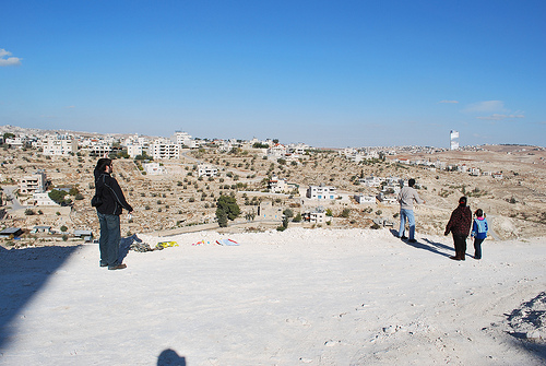
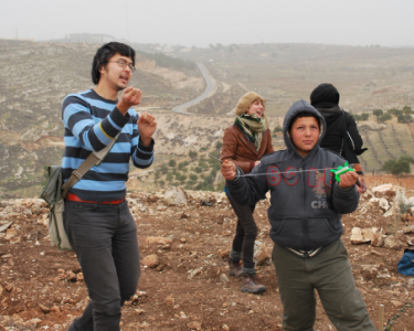
These two days definitely show the ‘worst case scenario’ for this kind of mapping… super high and low winds, steep valleys and ridges, low-res video and time limitations. Anyways the best part of the day was when two Palestinian kids and their dad came out to see who the idiots were who couldn’t fly a kite… and helped us get one in the air:

Coming soon – our last day of mapping in the middle east was at the Royal Scientific Society of Jordan, where we captured some absolutely fantastic images under some of the best conditions we’ve seen so far.

Umm Salamuna kite mapping

December 16th, 2009 by Jeffrey Warren

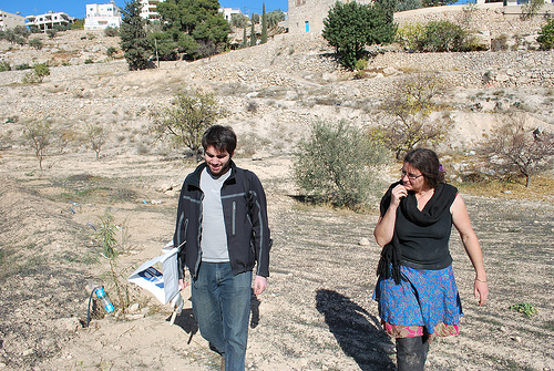
Josh Levinger and I met up with some activists who were planting trees in Umm Salamuna (view in Google Maps) on a hillside which is scheduled to be annexed by a nearby Israeli settlement, and converted into a graveyard. The planting was organized by Alice Gray of Bustan Qaraaqa, so that if the land is taken over, the trees would have to be uprooted or chopped down before the land can be used.. As I understand it, one of the means by which settlements claim land is by using an Israeli law which opens land to new settlement if it has lain fallow for more than three years — so planting the hillside may defend it from such a claim.

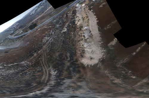
The wind was so strong that our first kite, carefully made that morning from dowels and Tyvek, shattered immediately. Instead, we launched a small soft kite with an iPod nano attached to it. Here’s a stitched image of the video footage we captured:

See all the pictures on Flickr.

The iPod has an SD camera which can capture many hours of video – and it’s so super light that we can fly it on a pocket kite. Many of the frames are blurred and the resolution is pretty poor (we’d thought of using a Flip camera but they’re more expensive and heavier) but when you go through the footage frame by frame you can find lots of good images. We then stitched these together with Calico and got the above image. It helped a lot to put a small ‘sail’ on the back of the iPod so it didn’t spin as much.

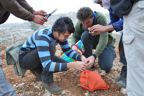
Everyone was cold but once we started flying the kites we all got really excited. The owner of the land was there with his kids and they helped assemble the rig and fly the kite:

kite-flying-2

The mapping was a big success – everyone ‘got’ why we were doing it, that documenting the tree planting and how they’re changing the landscape is a form of testimony. We’re still working to rectify the imagery, and I’d like to ask folks if they have any ideas – the stitching software we’re using assumes images were taken from a single viewpoint, but the kite and camera were moving all over the place. As you can see above, the stitching distorts things and we lose a lot of detail – how can we reconstruct a high-res image that assumes multiple perspectives? I’m looking at this tutorial to start with. We’re also thinking about an algorithm to dump the clear, undistorted and unblurred frames from a movie file. Ideas?

Cross-posted with Unterbahn.com