Grassroots Mapping is a series of participatory mapping projects involving communities in cartographic dispute. Seeking to invert the traditional power structure of cartography, the grassroots mappers used helium balloons and kites to loft their own “community satellites” made with inexpensive digital cameras.

This site has been merged into Public Lab

At Public Lab, we've grown the Grassroots Mapping community into a broader effort to enable communities to understand and respond to environmental threats with DIY techniques.

Read more and join us »

History & Future of Juan Pablo II

January 27th, 2010 by Jeffrey Warren

The CEDRO teachers and I were inspired by Jay Silver’s work with Awareness Mapping (watch his presentation here) and so we’ve been doing some paper mapping exercises, though focusing more on history and buildings and such. The ‘history of the community’ project (view on Flickr) went so well that we assigned a ‘future of the community’ assignment and asked kids to bring in maps or drawings of the community in 5-10 years. They came back with some great stuff (see the project on Flickr), and two students went nuts and made a whole scale model of the neighborhood (7 years from now) in 3D!

Notice the great attention to detail in multiple story homes. There’s a pharmacy, hair salon, etc. I’ll be uploading more photos of this assignment soon, including a panorama of the model town!

Initial Map Warper test with kite imagery

January 16th, 2010 by Jeffrey Warren

We’re working to process and rectify all the imagery we captured on Thursday, but here’s an initial attempt at rectifying an image. I must admit I was initially discouraged that the Google map seemed pretty decent (it’s supplied by DigitalGlobe) but now that I’m trying to actually rectify images against it, it’s really almost unusable!

I can’t see any useful detail, and almost all of the houses have moved or changed… about one in a hundred roofs match up, making it very difficult to rectify. I think we need one really good very high altitude shot to fix our overall layout, then we can rectify the lower altitude, higher detail imagery. We’ll try Tuesday afternoon.

Mapping with balloons, kites, and kids – first flights with Juan Pablo II in Lima

January 15th, 2010 by Jeffrey Warren

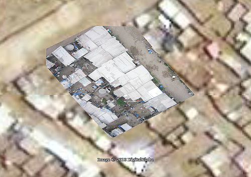
Yesterday Seth Hunter and I had our big flight with teachers from CEDRO and Manzanita “A” and the kids from invasion Juan Pablo II, and everything went extremely well. We started by reviewing the Google Maps imagery of the area (see previous post) and discussing their new homework project of writing about the history of the community, when their family arrived and from where, etc. (see the full homework on the Grassroots Mapping wiki). This was put together with the team from CEDRO — Ernesto, Sandy, Sara, and others, whose fantastic work and thorough understanding of the kids we’re working with has made this all possible. I’ve been very impressed with their personal commitment to the community – they know all the kids and their families, and have a very good rapport with the residents of Juan Pablo II.

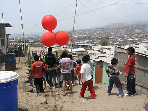
After a short discussion of the camera rig and some helium safety tips/rules, we set out to launch our first balloon – or rather 5 balloons, which is what it took to launch our camera.

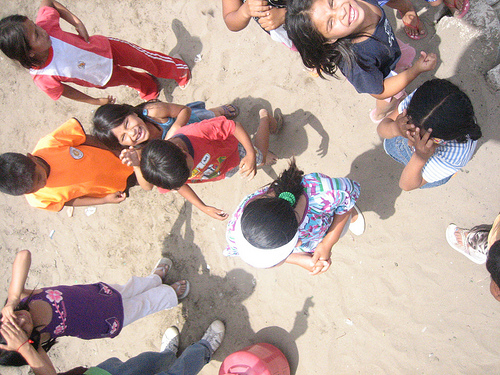
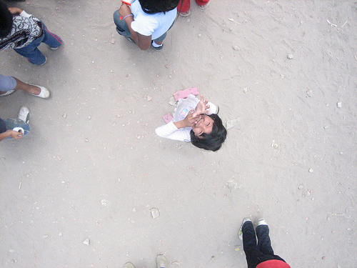
However, there was quite a bit of wind, and things got a bit turbulent. The rig kept getting pushed down by gusts, and with all the DIY electrical wiring around, we told the kids to let go of the string for a bit. Ultimately, though, we had a big crowd, and the kids helped with everything from filling balloons to tying the rigging — and most importantly, they had a ton of fun.

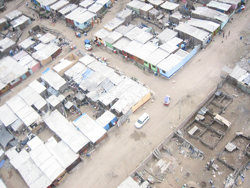
We were unsure about the pictures we’d get, and indeed we didn’t really get high enough with the balloons (see above) so later, with a smaller group of kids we tried flying kites, which worked fantastically – we got the camera up quite high and captured some really good imagery which we hope to rectify later today or tomorrow. To produce a complete map, we expect to repeat kite/balloon flights over the next week or so.

All in all, the day went terrifically well; many thanks to the aforementioned members of CEDRO as well as Carla del Carpio and Nancy, who were also there to participate.

The complete set of photos of the event are being uploaded to Flickr under the tag “grassrootsmapping”.

Juan Pablo II on Google Maps

January 15th, 2010 by Jeffrey Warren

Here’s Juan Pablo II (as far as I can tell) on Google Maps. (Link here)

It doesn’t look so bad in fact… we’d expected older imagery. But the detail is not quite good enough to make out which homes are which, and there are no labels or anything, so it’s quite hard to figure out where you are. We’ll see how these sync up with the higher resolution balloon imagery we capture… hopefully tomorrow!