
Initial Map Warper test with kite imagery
January 16th, 2010 by Jeffrey Warren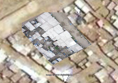
We’re working to process and rectify all the imagery we captured on Thursday, but here’s an initial attempt at rectifying an image. I must admit I was initially discouraged that the Google map seemed pretty decent (it’s supplied by DigitalGlobe) but now that I’m trying to actually rectify images against it, it’s really almost unusable!
I can’t see any useful detail, and almost all of the houses have moved or changed… about one in a hundred roofs match up, making it very difficult to rectify. I think we need one really good very high altitude shot to fix our overall layout, then we can rectify the lower altitude, higher detail imagery. We’ll try Tuesday afternoon.
Tags: juanpabloii, lima


January 16th, 2010 at 8:41 am
Stuart Gill from the World Bank has been asking whether we can tell what buildings are made of – and we almost can from this height. Roof material can be seen, and from some of the sideways images (like this one; see more at the Flickr feed) we can definitely make out wood/brick/plastic. But I’m hoping we can run around with the kids and do a quick survey of building materials anyways.
January 24th, 2010 at 10:08 am
A great idea with the balloons! Im working on a project that requires georeferencing, so this post caught my eye. Grass GIS (open source GIS) has a georeferencer utility and MapAnalyst (http://mapanalyst.cartography.ch/index.html) can calculate distortion.