May 13th, 2013 by Lynnrw
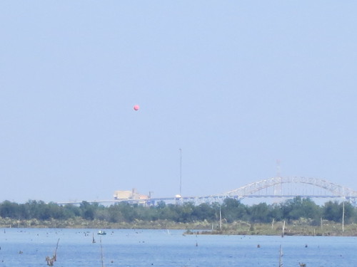
We're a neighborhood group in East Providence, RI with houses adjacent to a large construction waste grinding business. Toxic dust was filtering into our homes and yards from the plant. Many in the neighborhood suffer from respiratory and other health problems thought to be associated with the dust.
read more
Tags: balloon mapping, GrassrootsMapping
Posted in air quality, E. Providence, mapknitter, RI, syndicated, toxic waste, water quality | No Comments »
January 2nd, 2013 by Stewart Long
cross-posted from PBS's IdeaLab
Public Lab's balloon- and kite-based mapping approach is a new way to take aerial images from the ground. However, there are some considerations and things that can be learned from a few map stories.
Each map project has distinct characteristics in its time, place, and local atmospheric conditions. Here are several examples of how those factors make each balloon and kite map unique.
LAKE MERRITT (OAKLAND, CALIF.)
read more
Tags: balloon mapping, GrassrootsMapping
Posted in bay-area, featured, idealab, kite-mapping, syndicated | No Comments »
October 7th, 2012 by eustatic
TECHNICAL NOTE AND QUESTION
We're going to have to repeat this one. The camera shut down prematurely.
I attribute the failure to the use of duct tape on the camera trigger-- any thoughts on this are appreciated. From looking at the photo sequence, the camera gave out after a wind gust. Still, some interesting shots were taken.
And, in the future, i will be using the Common Ground kayaks, so repeating this day will be easier the second time.
shannon snaps our flight
read more
Tags: balloon mapping, GrassrootsMapping
Posted in gulf-coast, syndicated | No Comments »
July 16th, 2012 by Juan
If anybody is interested in ground control point targets for aerial photography, I can leave here this North arrow for you to print (courtesy of the Integration and Application Network, University of Maryland Center for Environmental Science (ian.umces.edu/symbols/).
Tags: balloon mapping, GrassrootsMapping
Posted in aerial photography, ground-control-points, kite-mapping, syndicated | No Comments »
May 10th, 2012 by Stewart Long
This was a bit lost in the hubbub over the Google announcement, but a few weeks ago we added a feature to order a print directly from MapKnitter and from the PLOTS map archive. Users can now click-through directly from their map details page. Public Laboratory map production is working towards a end-to-end open source solution:
- Planning. Getting started with Public Lab map tools, collaborate, learn about safety first
- Capture. Taking aerial images
- Sorting. Selecting the best images locally or online with mapmill.org
read more
Tags: balloon mapping, GrassrootsMapping
Posted in featured, kite-mapping, near-infrared-camera, syndicated | No Comments »
May 8th, 2012 by Stewart Long
cross-posted from PBS's IdeaLab. How We Got Here: The Road to Public Lab's Map Project
Last week, Public Laboratory announced that public domain maps are now starting to show up on Google Earth and Google Maps. But how did the projects get there? Here's a timeline of a Public Laboratory map project.
MAKING A MAP
read more
Tags: balloon mapping, GrassrootsMapping
Posted in featured, gulf-coast, idealab, kite-mapping, near-infrared-camera, new-york-city, syndicated | No Comments »
March 9th, 2012 by warren
Hello Public Labbers and Grassroots Mappers!
To date, the documentation and open science literature we've made as a community has been published under a Creative Commons ShareAlike license, allowing anyone to reuse, remix, adapt, improve, and redistribute our works. Today, the PLOTS Web working group would like to propose that we as a community adopt a separate license for our hardware designs, and after much consultation, we'd like to adopt the CERN Open Hardware License.
read more
Tags: balloon mapping, GrassrootsMapping
Posted in kite-mapping, licensing, near-infrared-camera, ohl, open hardware, open source, somerville-massachusetts, spectrometer, syndicated, thermal-photography | No Comments »
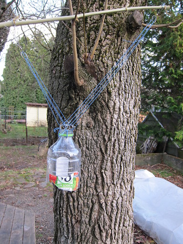
February 5th, 2012 by mathew
A Picavet rig is a very common type of KAP/BAP rig, I've added it to the juice bottle in a fairly simple way, using 1/2" key rings.
read more
Tags: balloon mapping, GrassrootsMapping
Posted in kite-mapping, portland, syndicated, video | No Comments »


