March 1st, 2013 by KalynRosenberg
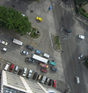
A kite aerial photography field report
Date of flight: January 27, 2013
Site: North Branch Nature Center, Montpelier, Vermont
Occasion: Ice on Fire deep winter celebration
read more
Tags: GrassrootsMapping
Posted in featured, kite-mapping, syndicated, vermont | No Comments »
January 2nd, 2013 by Stewart Long
cross-posted from PBS's IdeaLab
Public Lab's balloon- and kite-based mapping approach is a new way to take aerial images from the ground. However, there are some considerations and things that can be learned from a few map stories.
Each map project has distinct characteristics in its time, place, and local atmospheric conditions. Here are several examples of how those factors make each balloon and kite map unique.
LAKE MERRITT (OAKLAND, CALIF.)
read more
Tags: balloon mapping, GrassrootsMapping
Posted in bay-area, featured, idealab, kite-mapping, syndicated | No Comments »
November 8th, 2012 by eymund-diegel
An ordinary looking concrete slab in Brooklyn - what story does it really tell ?
"To balloon or to kite, that is the question.."
Just after Independence Day 2012, the “Over My Dead Body” balloon mapping expedition set out to capture high resolution aerials of a very special grave site: America’s first ever military cemetery.
Their site of interest was none other than the fabled Marylander Burial Ground, rumored location of the first soldiers ever to die as Americans in the 1776 War of Independence.
read more
Tags: GrassrootsMapping
Posted in 27 August 1776, American pie, battle of brooklyn, featured, Gowanus Canal Conservancy, marylander burial ground, new-york-city, Red Balloons, syndicated, veterans day | No Comments »
October 4th, 2012 by mathew
This interview is from the summer issue of Grassroots Mapping Forum, our quarterly print publication. Subscribe here.
Shannon Dosemagen sat down with Scott Eustis of the Gulf Restoration Network to discuss the shifting sands and fortunes of the Mississippi Delta and the Chandeleur Islands
Can you tell me a bit about GRN, the work you’re doing with them, mission, some of the work that your co-workers are doing?
read more
Tags: GrassrootsMapping, wetlands
Posted in chandeleur islands, featured, grassroots mapping forum, gulf restoration network, gulf-coast, interview, restoration, syndicated | No Comments »
May 10th, 2012 by Stewart Long
This was a bit lost in the hubbub over the Google announcement, but a few weeks ago we added a feature to order a print directly from MapKnitter and from the PLOTS map archive. Users can now click-through directly from their map details page. Public Laboratory map production is working towards a end-to-end open source solution:
- Planning. Getting started with Public Lab map tools, collaborate, learn about safety first
- Capture. Taking aerial images
- Sorting. Selecting the best images locally or online with mapmill.org
read more
Tags: balloon mapping, GrassrootsMapping
Posted in featured, kite-mapping, near-infrared-camera, syndicated | No Comments »
May 8th, 2012 by Stewart Long
cross-posted from PBS's IdeaLab. How We Got Here: The Road to Public Lab's Map Project
Last week, Public Laboratory announced that public domain maps are now starting to show up on Google Earth and Google Maps. But how did the projects get there? Here's a timeline of a Public Laboratory map project.
MAKING A MAP
read more
Tags: balloon mapping, GrassrootsMapping
Posted in featured, gulf-coast, idealab, kite-mapping, near-infrared-camera, new-york-city, syndicated | No Comments »
February 2nd, 2012 by anita
We held a Ballon Mapping and Kite Making Workshop on the Campus of San Marcos on Jan. 28, 2012 with a group of about 10 people from: Open Street Map Peru, Saberes Nomadas, and San Marcos Univ. (physics, geography, sociology, and geographic engineering depts.)

read more
Tags: balloon mapping, GrassrootsMapping, lima
Posted in artisanal, featured, kite-mapping, Peru, syndicated | No Comments »
January 25th, 2012 by maning
This post has been syndicated from EPSG4253.wordpress.com
Today, we had a balloon mapping experiment. For a very brief airtime, we got some really impressive images.

read more
Tags: balloon mapping, GrassrootsMapping
Posted in featured, philippines, syndicated | No Comments »


