Grassroots Mapping is a series of participatory mapping projects involving communities in cartographic dispute. Seeking to invert the traditional power structure of cartography, the grassroots mappers used helium balloons and kites to loft their own “community satellites” made with inexpensive digital cameras.

This site has been merged into Public Lab

At Public Lab, we've grown the Grassroots Mapping community into a broader effort to enable communities to understand and respond to environmental threats with DIY techniques.

Read more and join us »

Guides

May 10th, 2010 by Stewart Long

Illustrated guides are available, covering needed materials, assembly, and use:

Illustrated Guide in English (1mB, 4 pages)

Guia Ilustrada en Castellano (99kB)

Illustrated Guide in Georgian (26mB, ugh, i know)

מדריך מאוייר למיפוי עצמאי עם בלונים או עפיפונים (in A4, 3.1mB, and on letter-sized paper, 3.1mB)


For those interested specifically in the oil spill, some checklists and handouts are available here to get started making aerial maps of the spill:

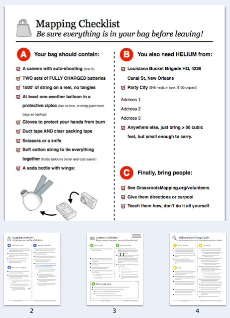
Quick Guide to Mapping the Oil Spill