
Balloon Mapping the University of Kentucky Campus
December 9th, 2011 by Jeffrey Warren
Reposted from a Public Laboratory research note by Jeremy Crampton
The UK campus is getting mapped–with helium-filled balloons!
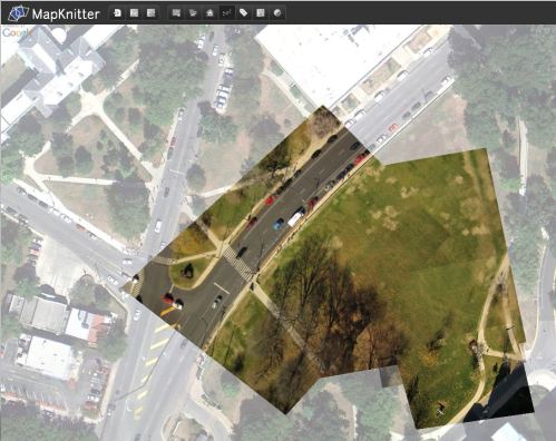
As part of an ongoing project associated with the Public Laboratory for Open Technology and Science (PLOTS) UK geography faculty and students have begun to map the campus from the air using balloons. The balloons, which are filled with lighter than air helium gas, are “tethered” with lengths of kite twine, to which a special camera rig (made from a recycled plastic soda bottle) is attached.
The camera dangles down and is set to take pictures every second. The pictures can then be “stitched” together in the PLOTS Map Knitter site.
This results in a composite image of the campus, which can be extended over time as more balloon missions are flown.
Follow our progress on the New Maps website!


December 20th, 2011 at 8:52 pm
Hey Jeffrey, cool to see you doing work in my home state of Kentucky. Keep up the kick ass efforts and hopefully we cross paths some time again soon 🙂
December 21st, 2011 at 4:19 am
Hey Brian! Good to hear from you. I didn’t actually write this post, though, just reposted it from Jeremy’s.