Processing fixed wing imagery
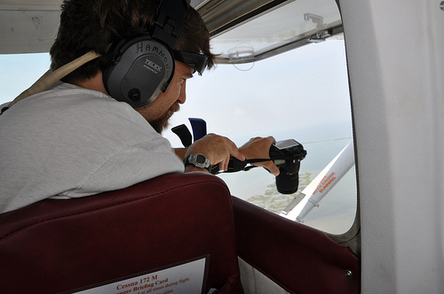
October 21st, 2010 by Stewart LongThe flights were typical of DIY Cessna imagery collection. The Camera is held in approximate “geodata position” by a rubberized cabinet clamp. The camera operator stays quite busy though by holding the rig to dampen vibrations, shooting images, and communicating with the pilot. All this is happening with the window wide open and the plane travelling around 130 MPH, making it quite noisy in the cabin.
Google Earth and imagery within the historical time slider was used concurrently with other existing imagery sources from the region to process the new data from the flight. The map contains oil pollution/dispersants.


November 10th, 2010 at 10:39 am
Lessons learned from this experience:
1) A skilled pilot really helps. Flying along a coastline is a skill many pilots do not have, so it is worthwhile to ask.
2) Conditions are crucial: we couldn’t fly higher than about 1000 ft. because of haze, therefore our swath size was very limited. Flying at a lower altitude, it was harder to capture the coastline.
3) Test your rig on the ground, especially the attachment to the airplane. Cessna 172 or similar work well.
Regarding #1 above: Our pilot had over 50 years of flying experience and no on board navigation systems. He literally took out a large paper map of the area right after takeoff (I wish I was kidding). As you can imagine, this limited us.