
Sunday balloon imagery of oil at Chandeleur islands
May 10th, 2010 by Jeffrey Warren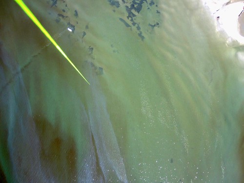
Here’s Stewart leading a team on the west side of Chandeleur:
More data soon… processing now.
Here’s Stewart leading a team on the west side of Chandeleur:
More data soon… processing now.
Are you embroiled in an cartographic dispute? Do you disagree with the official version of your geography? Contact us through the public mailing list.
Grassroots Mapping is part of the Public Laboratory for Open Technology and Science, founded by a group of activists, educators, technologists, and community organizers interested in new ways to promote action, intervention, and awareness through a participatory research model.
We're now trying to learn from our balloon mapping experiences to develop new DIY tools with a variety of local communities. This is an open community and you are welcome to join, and encouraged to contribute!

Purchase the Grassroots Mapping Forum, our new community research journal/archive/zine/map, where we hope to share ideas, techniques, and stories from the Grassroots Mapping community. It is printed on a single 22.75x35" newsprint sheet, folded down to just over letter size, and includes a full color reproduction of a grassroots map along with essays, illustrated guides, and interviews on the reverse.
You can find out more, and purchase the first issue here for $17 shipped.

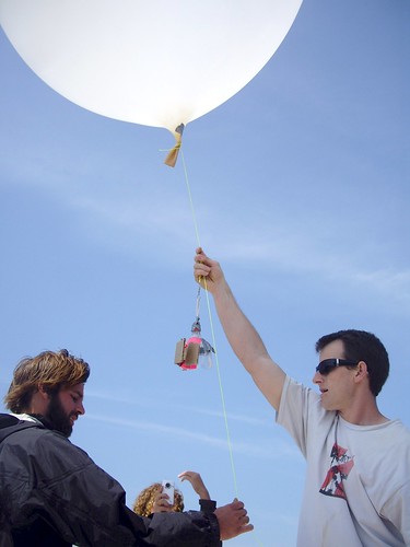
We're helping citizens to use balloons, kites, and other simple and inexpensive tools to produce their own aerial imagery of the spill… documentation that will be essential for environmental and legal use in coming yeas.We believe in complete open access to spill imagery and are releasing all imagery into the public domain.
You can see all of our data here: http://publiclab.org/archive/.
Browse some of our best imagery on Flickr.

Techniques and tools for people who want to make maps, on the Public Laboratory wiki. Includes readings and case studies on grassroots mapping projects.

Instructions on how to use cameras on weather balloons to create high-resolution maps.

Want to start mapping? See the Balloon Mapping Materials List to get started.


