Birds and oil visible in most recent citizen map of southern Chandeleur islands
May 16th, 2010 by Jeffrey Warren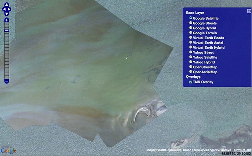
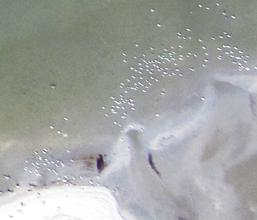
Stewart Long finished up a fantastic stitched map from the trip he led on May 9th to the southern Chandeleur Islands. Using a helium balloon, he and a group from Louisiana Bucket Brigade produced this extremely high resolution map of an oil slick surrounding a sandbar.
The boat was offered by Jim Smith of Uptown Angler (we were put in touch with him via Spencer Moss of FishingGuidesWorld.com) — many thanks!
You can view the full map in OpenLayers here: tiled web map
There is also a GeoTiff: chandeleur-balloon.tif (278mB)
What’s truly amazing about this map is that you can see individual birds and streaks of oil on the sandbar at the bottom (see below for full resolution).