
New poster of Grassroots Mapping Kit
March 19th, 2010 by Jeffrey Warren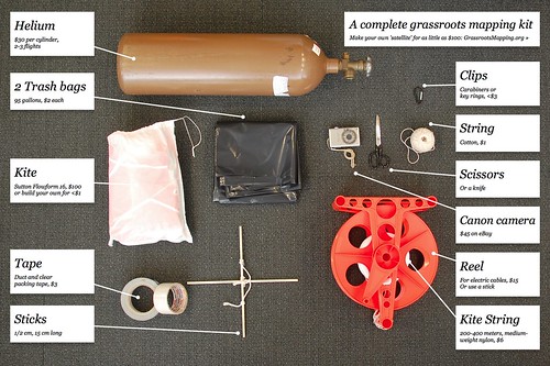
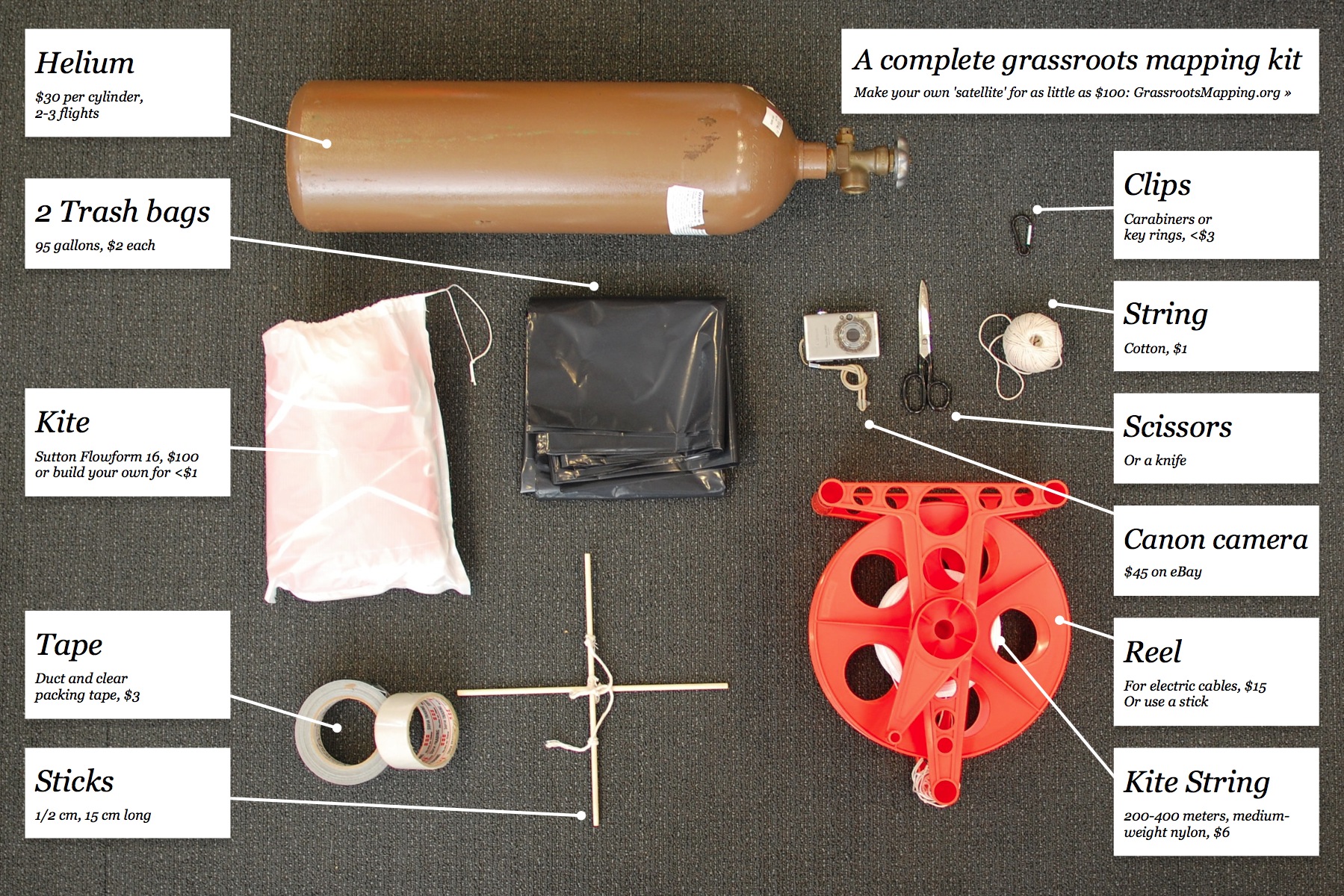
After some discussion on the mailing list, I put together this poster/handout image which shows everything you need to make a balloon or kite map (besides people!). Feel free to distribute! I’ll start printing this on the back of the print maps I make, and hopefully this will help people get started making their own maps.
Download the Full size image


