Public Lab Barn Raising: Collaborative Infrared Tool Development
November 5th, 2011 by Shannon DosemagenWritten by Stephen Debique
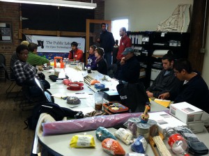
On Friday, October 21st a diverse and multi-disciplinary group convened in Asheville, North Carolina to discuss, develop and prototype a low-cost, large scale, remote sensing system targeting the visible and near-infrared band combination. There were participants from all over the United States, including Public Laboratory for Open Technology and Science (PLOTS) staff from Louisiana, Massachusetts, and New York, a local Asheville remote sensing expert, and many others. We initially spent a few hours getting to know each other and Shannon Dosemagen helped usher along the introductions by posing some staging questions. Many participants expressed their keenness to learn and take what they learned and apply it in their individual work and research efforts. I also felt similarly and was very excited to work on a process that could possibly help a comparatively lesser-developed nation as my own, Trinidad and Tobago. After the lightning talks and introductions, a short presentation was given to us by RiverLink staff members, Nancy Hodges and Hayley Smith about the French Broad River, their conservation, restoration and remediation efforts. We were also given a brief overview of the areas where we would be launching our balloon mapping cameras over the course of the next day by Adam Griffith, of PLOTS. We were informed that we would be joined on Saturday by RiverLink volunteers who would also engage in mapping the local area with us. After this we all went out to enjoy some official Asheville vegetarian and vegan cuisine.
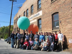
Saturday, October 22nd started with some breakfast from the local bakery and then back to the RiverLink headquarters for planning and dispersal into multiple teams. We split into three groups to maximize participation and learning amongst the 30 or so people gathered to help map the French Broad River surrounding areas. My group took on the Carrier Park, a greenway site, and was led by Jeffrey Warren and Shannon Dosemagen. They taught us the basics of setting up the camera rigs and basic flight planning that was unique to launching helium balloons. All of the participants seemed engaged and relatively amazed that one could use consumer technology to produce maps that seemed so ivory tower to them previously. After the RiverLink mapping mission was completed around noon we all met back at the RiverLink office to enjoy a Venezuelan lunch hosted by PLOTS and a local food truck.
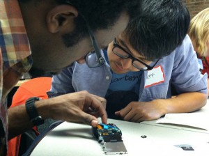
After lunch we began to speak and work more intensely on our stated purpose – remote sensing using the visible and infrared bands. During the after-lunch session we were all led by Jeffrey Warren in hacking on Canon A490 model cameras so that they would no longer filter out the near-infrared band and would only filter the visible part of the spectrum. Most of the hacking was relatively easy and straightforwad thanks to the simple Canon design. One innovation we developed during our modest hacking process was to cut the filter and place it in the exact position as the manafacturer provided filter. This seemed like a straightforward idea but turned into some intense surgery which in my case needed nimbler hands. All-in-all, the whole infrared conversion process can be easily reproduced and should pose hardly any issues once the appropriate tools are available (specifically ultra-small jeweler screwdrivers and tweezers). Once we had completed our hacking session many ideas of how the technology could be used by a multitude of stakeholders were tossed around, with many agreeing that the high temporal resolution and ease-of-use were key factors in the usefulness of our grassroots process and system. PLOTS also was kind enough to donate one of the hacked cameras to my own small format aerial imagery research efforts. At the end of a long day we all agreed to reconvene at Adam’s house for an appropriate camp-fire dinner and post-discussion.
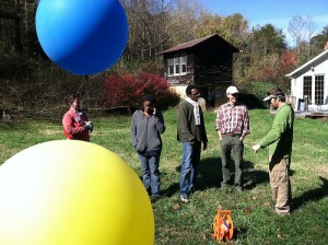
After breakfast on Sunday, October 23rd we all travelled over to Thatchmore Farm in Leicester, North Carolina where we were hosted by Tom and Karen, the owners of the ten-acre USDA organic farm; and Ashley, a farm apprentice. Although I had hoped that perhaps they would want to utilize the near-infrared spectrum for monitoring the forestry aspects of their 10-acre plot or for a low-cost method of monitoring crop health, Tom explained to us that one of his goals for using aerial photography was to help him document his recent efforts to expand his farming enterprise. After a short tour and pre-flight planning we split into two groups so that we could ultimately gain full geographic coverage as well as provide some failure proofing for our prototype cameras. We also tried dual-camera rigs, one taking natural color model aerial photographs and the other near-infrared aerial photographs. Both of our flights had minor issues with camera storage and weight, however, we managed to gain some potentially useful photography.
After collecting the geospatial data and grabbing a quick lunch we once again gathered at the RiverLink main office to hold a wrap-up session. The wrap-up session proved to be very fruitful and we all went away with a new sense of where this grassroots development should perhaps be heading. Some of the future work we agreed to follow up on included:
Site-specific goals at French Broad River
– ID invasive species, conservation easements
– MSD-sewage, straight-pipe sewage for tracking
– Species classification
– Open source classification using — http://www.dpi.inpe.br/spring/ – open source classification
Research goals
– Low-cost high-res DEM for farmers using bundle adjustment
– Reclamation sites – quantify lost biomass and diversity
– Bundle adjustment for canopy/biomass plus 4-band classification for diversity
– Crop health – relate to Thatchmore farm?
– Phosphorus limited? $5 test vs. ground-based IR camera system?
– Try blue-blocking single-camera IR setup. Need a way to get a pure non-infrared channel.
I was truly inspired by the work that we conducted over the course of the weekend and felt like one aspect of the system that I would particularly be interested in investigating is the application of small format aerial photography and remote sensing to planning New Agrarianism projects. Also worth investigating,are the potential spatial accuracy, radiometric resolution and spectral resolution short-comings associated with such grassroots, consumer electronics based technology and how these shortcomings can be improved so that the remote sensing system can be more broadly useful yet still maintain its democratic flare. On Sunday evening the barn raising came to an end and it was then off to our respective cities and towns, saying our myriad of sad goodbyes, yet welcoming new opportunities and ideas for bettering our planet.


