Largest balloon map so far in Mestia, Georgia
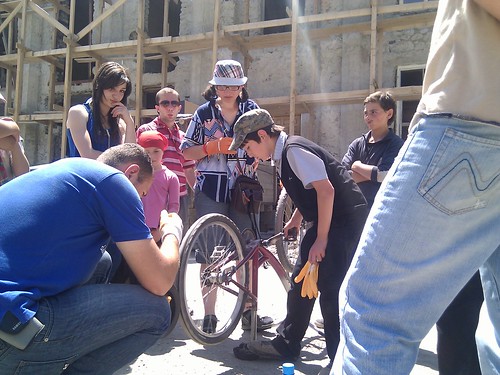
July 16th, 2010 by Jeffrey WarrenFor the last few weeks, I’ve been working with JumpStart International’s project, OpenMapsCaucasus in Georgia, teaching balloon-mapping workshops. With OMC’s Austin Cowley, I had the amazing opportunity to travel to Svaneti in the northwest of Georgia, where we collaborated with local OMC staff and a group of enterprising school kids to map the entire city of Mestia:
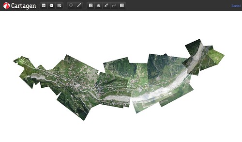
The map, 5.5 kilometers from end to end, is the largest area ever mapped using these techniques, and was completed in less than 3 days, with a 6-foot helium balloon flying up to 1.4 kilometers above the ground. Below, you can see the flight paths of our first 3 launches, recorded with a lightweight GPS which we attached to the balloon:

The trip is the first of a series of mapping expeditions and workshops I’ll be teaching with OMC staff across the country, and the imagery will be used to improve the public domain map that OMC is developing.